Eastern Upper Peninsula: 4 Days, 3 Lakes, 36 Islands
Last Updated: April 2026
The Eastern Upper Peninsula is the half of Michigan most travelers see first — you cross the Mackinac Bridge and you’re in it — but it’s also the half that rewards the slowest exploration. Three Great Lakes (Michigan, Huron, Superior) plus the St. Mary’s River meet here in a region that contains Michigan’s oldest city, the largest waterfall east of the Mississippi, 36 sheltered islands you can paddle in a single afternoon, and one of the most haunting Lake Superior memorial sites in the country. This is a region of deliberate contrasts: sandy Lake Huron beaches on one side, rocky Lake Superior shipwreck coast on the other, with thick forests, freighter shipping channels, and 50-foot waterfalls everywhere in between.

I’ve been driving the Eastern UP for years now and I’m still finding things — the kind of place where Brown Fisheries Fish House in Paradise quietly sells lake trout out of a third-generation commercial fishing operation that closes the moment they run out of fish, where the Tahquamenon River flows amber from cedar tannins, where Whitefish Point sits as the closest navigation mark to the wreck of the Edmund Fitzgerald just 17 miles offshore. This guide is what I wish someone had handed me before my first trip: what’s actually worth your time, where to base for the night, what’s open in 2026, and how to plan the four-day loop most first-timers actually need.
📍 At a Glance: Eastern Upper Peninsula
- 🌉 Gateway: Mackinac Bridge (5-mile crossing) into St. Ignace, the gateway city
- 🏛️ Oldest city: Sault Ste. Marie — Michigan’s oldest city, founded 1668
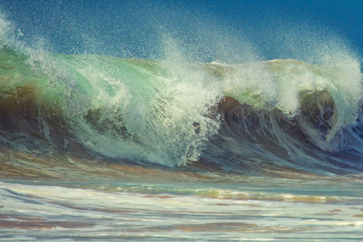
- 💧 Biggest waterfall: Upper Tahquamenon Falls — 200 ft wide, 48 ft drop, second-largest by volume east of the Mississippi
- 🚢 Engineering wonder: Soo Locks raise/lower ships up to 21 feet between Lake Superior and Lake Huron
- 🏝️ Islands: 36 in the Les Cheneaux archipelago alone, plus Mackinac Island and Drummond Island
- ⚓ Shipwreck coast: Whitefish Point sits just 17 miles from the wreck of the Edmund Fitzgerald
- 🌳 National Forest: Hiawatha National Forest covers 880,000+ acres across the region
- 📅 Best for first-timers: 4-day loop covering St. Ignace → Mackinac Island → Sault Ste. Marie/Paradise → Newberry
How to Use This Eastern UP Guide
I’ve organized this around how the region actually flows when you drive it — across the bridge into St. Ignace first, then either east along the Lake Huron coast (Les Cheneaux Islands, De Tour Village) or north to Sault Ste. Marie, then west toward the shipwreck coast (Brimley, Whitefish Point), inland to Tahquamenon Falls, and back south along the US-2 Lake Michigan shoreline. For first-time visitors, the four-day loop below is the most-recommended itinerary by Michigan tourism: Day 1 St. Ignace, Day 2 Mackinac Island, Day 3 Sault Ste. Marie/Paradise, Day 4 Newberry/McMillan. Locals and return visitors will want to add a second loop east through the Les Cheneaux Islands and Drummond Island.
⚡ Quick Picks by Interest
- 👨👩👧 Best with Kids: Mackinac Island ferry, Soo Locks viewing, Castle Rock climb, Tahquamenon Lower Falls boat rentals
- 💰 Best Free or Cheap: Soo Locks Visitor Center (free), Castle Rock ($1), Bridge View Park, Whitefish Point lighthouse grounds
- 🐕 Best Dog-Friendly: Tahquamenon Falls trails (6-ft leash), Brimley State Park beach, most public beaches and waterfront parks
- ♿ Best Accessible: Bridge View Park, Tahquamenon Upper Falls (new 900-ft accessible boardwalk opening spring 2026), Soo Locks Visitor Center
- 📸 Best for Photos: Mackinac Bridge from Bridge View Park, Tahquamenon Upper Falls, Whitefish Point lighthouse, Crisp Point at sunset
- 🚢 Best for History: Great Lakes Shipwreck Museum at Whitefish Point, Soo Locks, Museum of Ojibwa Culture (St. Ignace), Museum Ship Valley Camp
- 🍽️ Best for Food: Brown Fisheries Fish House (Paradise — cash only), Tahquamenon Falls Brewery & Pub, Lehto’s Pasties (St. Ignace)

St. Ignace: Gateway to the Eastern UP
Cross the 5-mile Mackinac Bridge from Mackinaw City and you’ll land in St. Ignace, which Michigan tourism officially calls the gateway to the Upper Peninsula. Smaller than its bridge-mate Mackinaw City on the south side, St. Ignace has well-maintained waterfront parks, sandy swim beaches, fudge shops, and the docks for the Mackinac Island ferries — Arnold Transit and Shepler’s both run from here. St. Ignace is also Michigan’s second-oldest European settlement, founded in 1671 by Father Jacques Marquette. Most visitors use it as their first overnight base in the UP.
Things to Do in St. Ignace
Castle Rock is the requisite first stop three miles north of St. Ignace — a 195-foot limestone “sea chimney” with about 170 steps to a viewing deck that gives you a 20-mile panorama of Lake Huron, Mackinac Island, and downtown St. Ignace. Admission is $1 (yes, really), and the gift shop with its hand-crafted birch bark ceiling has been operated by the Eby family since 1929. Open daily May through mid-October. The Paul Bunyan and Babe the Blue Ox statues at the base are mandatory selfies.
The Museum of Ojibwa Culture at 500 N. State Street tells the layered story of the Anishinaabek people, the French fur trade, and Father Jacques Marquette’s mission. The exhibits stretch back several hundred years and the building stands on the site of Marquette’s original 1671 mission. It’s small, well-curated, and worth an hour even if you think you don’t care about regional history — the Anishinaabek partnership content is some of the most thoughtful interpretation in the Eastern UP.
Bridge View Park — wheelchair-accessible, with covered picnic shelters, comfortable benches, and an in-pavilion display detailing the construction of the Mackinac Bridge — is the quiet favorite for bridge photography without paying Castle Rock’s $1 or driving to Mackinaw City. Other St. Ignace beach picks include American Legion Memorial Park (sandy beach, playground, pavilion) and Kiwanis Beach on Moran Bay (picnic area, pavilion).

Where to Eat in St. Ignace
You can’t visit anywhere in the UP without encountering the pasty — a hand-held pie of meat and vegetables in a flaky crust, brought over by Cornish copper miners and now firmly embedded in the regional identity. Pronounced “PASS-tee,” not “PASTE-y.” There’s an unwinnable local debate about whether to eat them with ketchup or gravy; locals tend toward gravy or nothing.
- Lehto’s Pasties — north of St. Ignace on US-2, family-operated since 1947, the most-cited pasty in the area
- Driftwood Restaurant and Sports Bar — local favorite for whitefish and burgers
- Mackinac Grill Waterfront Pub — bridge views, casual menu
- B.C. Pizza — solid pizza, late hours

Where to Stay in St. Ignace
- Best Western Harbor Pointe Lakefront — Lake Huron waterfront, walking distance to the ferry docks
- Quality Inn Lakefront — bridge views, family-friendly
- Bear Cove Inn — quiet, off the main strip
- Straits State Park (camping) — bridge-view camping with a scenic outlook platform

The Les Cheneaux Islands & Lake Huron Shoreline
Head east from St. Ignace on M-134 and you enter one of Michigan’s quietest stretches of waterfront — the Les Cheneaux Islands, an archipelago of 36 islands strung along 12 miles of Lake Huron coastline. The name is French for “the channels,” which is exactly what they are: sheltered passages between low wooded islands, perfect for kayaking, sailing, and small-boat fishing. The base towns are Cedarville and Hessel, historic port towns that still feel like working harbors. Hessel hosts the Antique Wooden Boat Show in August — one of the largest in the Great Lakes.
Things to Do in Les Cheneaux
Woods & Water Ecotours in Hessel runs guided kayak, bike, snowshoe, and hiking tours through the islands and surrounding mainland — sunset paddles are the standout, when you can hear loons and watch wildlife along the shallow channels. They also rent kayaks, bikes, and snowshoes seasonally if you’d rather go independent.
Les Cheneaux Islands Historical Association Maritime Museum in Cedarville is housed in a 1920s-era boathouse and showcases vintage wooden boats, antique outboard motors, marine artifacts, and historic boating photographs. There’s also a working boat-building school on site that occasionally offers drop-in classes for visitors. The Applecore General Store nearby is the local catch-all — Michigan-made foods, gifts, and home goods in a 120-year-old farmhouse.
De Tour Village & the DeTour Reef Lighthouse
Continuing east on M-134 brings you to De Tour Village, the eastern end of the Eastern UP mainland and the gateway to Drummond Island via the De Tour Drummond Island Ferry (10-minute crossing, runs hourly year-round). The DeTour Reef Lighthouse stands one mile offshore in northern Lake Huron, an 83-foot-tall structure built in 1931 to guide ships through the St. Marys River channel between Lake Huron and Lake Superior. It’s operated by the DeTour Reef Light Preservation Society and offers seasonal day tours and an overnight keeper program where you can stay in the lighthouse — book months in advance.

Sault Ste. Marie: Michigan’s Oldest City & the Soo Locks
Sault Ste. Marie (pronounced “Soo Saint Marie”) is Michigan’s oldest city, founded in 1668 by French Jesuit missionaries on the banks of the St. Mary’s River — and the second-largest city in the Upper Peninsula. The Sault Ste. Marie International Bridge crosses to Sault Ste. Marie, Ontario on the Canadian side, and the river itself joins Lake Superior to Lake Huron. Lake Superior sits about 21 feet higher than Lake Huron, which is the entire reason the Soo Locks exist.
The Soo Locks
The Soo Locks are one of the most engineering-significant waterway systems in the world — they raise and lower freighters up to 21 feet to allow passage between Lake Superior and the lower Great Lakes. Roughly 7,000 ships pass through annually, carrying iron ore, coal, grain, and other commodities. The Soo Locks Visitor Center has free observation platforms where you can stand directly above a lock as a 1,000-foot freighter rises or falls beside you. It’s one of the more genuinely awe-inspiring free experiences in Michigan.
More to Do in Sault Ste. Marie
Museum Ship Valley Camp on Water Street is a retired Great Lakes freighter converted into a 20,000-square-foot maritime museum — including a small aquarium, two original lifeboats from the Edmund Fitzgerald, and walk-through engine room exhibits. The Tower of History at 326 E. Portage rises 210 feet for panoramic views of the locks, the river, and up to 1,200 square miles of surrounding wilderness on a clear day. Rotary Island Park on the St. Mary’s River has up-close shipping channel views, kayak launches, a kids’ fishing pond, and a playground. Soo Brewing Company is the local craft beer pick — one of Michigan’s many craft breweries.

Brimley to Whitefish Point: The Shipwreck Coast
West of Sault Ste. Marie along the Lake Superior coast is the small town of Brimley, sitting on Waiska Bay (a shallow protected bay where Lake Superior water is meaningfully warmer than open water — meaningful in a relative sense; this is still Lake Superior). Brimley State Park is a full-service campground with wheelchair-accessible features and one of the only sandy Lake Superior beaches warm enough for actual swimming.
Point Iroquois Lighthouse, just west of Brimley, is over 150 years old (built 1855, current tower 1870) and marks the entrance of the St. Mary’s River into Lake Superior. The 65-foot tower is climbable — spiral stairs to the top — with views of Lake Superior, Canada, and freighters passing toward the Soo Locks. The keeper’s quarters has been converted to a small museum.
Whitefish Point & the Edmund Fitzgerald
Whitefish Point sits at the tip of a long cape that marks the entrance of Whitefish Bay into Lake Superior — and is the closest navigation mark to the wreck of the SS Edmund Fitzgerald, just 17 miles offshore. Every vessel entering or leaving Lake Superior passes Whitefish Point. The site holds three things you can visit:
- Great Lakes Shipwreck Museum — one of the most thoughtful maritime museums in the country, with the original ship’s bell from the Edmund Fitzgerald (recovered from the wreck site in 1995) as its centerpiece. Open daily May 1–October 31.
- Whitefish Point Light Station — Lake Superior’s oldest active lighthouse, in operation since 1849.
- Whitefish Point Bird Observatory — a globally significant bird migration corridor, designated an Important Bird Area by the American Bird Conservancy. Affiliated with Michigan Audubon.
The annual Edmund Fitzgerald Memorial Service at Whitefish Point on November 10 is one of the most moving public memorials in the Great Lakes — the museum bell tolls 29 times for each lost crew member.
Whitefish Bay National Forest Scenic Byway connects Brimley to Paradise along Lake Superior, with shoreline turnouts and pull-offs. It’s one of the prettier drives in the Eastern UP in any season.
🐟 Don’t skip Brown Fisheries Fish House in Paradise. A third-generation commercial fishing operation that sells fresh-caught lake trout, smoked whitefish, fish and chips, and fish chowder — boats head out each morning and the place closes when they run out of fish. Cash only — no credit or debit cards accepted. Worth planning your day around.

Tahquamenon Falls State Park
Tahquamenon Falls State Park covers nearly 50,000 acres of Paradise, Michigan (yes, that’s really the town’s name), and stretches more than 13 miles of the Tahquamenon River. It’s Michigan’s second-largest state park, after the Porcupine Mountains. There are two waterfalls along this stretch:
- Upper Falls — 200 feet wide with a 48-foot drop. By volume, it’s the second-largest waterfall east of the Mississippi River (after Niagara). The amber color comes from tannins leached from cedar and hemlock swamps upstream.
- Lower Falls — a series of five smaller cascades flowing around an island. Rowboat rentals at the Lower Falls Café let you paddle out to the island for a closer look (Memorial Day weekend through mid-October).
Important 2026 update: A new fully accessible 900-foot-long boardwalk at the Upper Falls is currently under construction (broke ground October 2024), with completion slated for spring 2026. All other Upper Falls viewing platforms remain open during construction, as does the Tahquamenon Falls Brewery & Pub. The new boardwalk is part of a $3.275 million renovation project funded through the Building Michigan Together Plan.
♿ ADA-Accessibility: A track wheelchair is available for use at the park, made possible by Kali’s Cure for Paralysis. The new 2026 boardwalk will significantly expand accessible access at the Upper Falls.
The Tahquamenon Falls Brewery & Pub at Camp 33 next to the Upper Falls is one of the only sit-down restaurants for miles — open 7 days a week, 11 AM to 8:30 PM (2026 schedule). They’re known for locally-caught whitefish, bison burgers, UP pasties, and house-brewed Harvest Wheat. Connected gift shop. Pet-friendly patio.
Hunter Shuttle Service runs a fee-based shuttle between the Upper and Lower Falls daily noon–8 PM through Labor Day weekend, so hikers can do the 4-mile River Trail one-way. Call or text 906-291-3422 for current schedule. (Note: the River Trail is closed in winter due to unsafe conditions.)

Luce County: Newberry, Crisp Point, & the Two-Hearted
West of Tahquamenon Falls and Whitefish Point is Luce County, with Newberry as its hub. Newberry is officially the “Moose Capital of Michigan” — most moose sightings in the region happen within Tahquamenon Falls State Park or surrounding state forest. The county is heavily forested with state forest land, with three standout stops:
Crisp Point Lighthouse
Crisp Point Lighthouse sits on a remote stretch of Lake Superior shoreline (not Lake Michigan, despite some sources getting this wrong) — about 14 miles west of Whitefish Point. The 58-foot brick tower was built in 1903–1904 and named for Christopher Crisp, the iron-willed Life-Saving Station keeper. It was decommissioned in 1993, nearly lost to Lake Superior erosion in the 1990s, and saved by the volunteer-run Crisp Point Light Historical Society. Today the lighthouse and visitor center are open mid-May to mid-October, approximately 10 AM to 6 PM — hours depend entirely on volunteer availability and weather.
Reaching Crisp Point requires earning it. The last 18 miles to the lighthouse are gravel/sand county road that takes about an hour to drive carefully — Tripadvisor reviewers compare it to an ATV trail. The road isn’t snowplowed in winter and the last 7 miles double as Snowmobile Trail 8 in winter (don’t drive a car on it). The grounds and beach are open year-round; the tower and visitor center are seasonal.
Muskallonge Lake State Park
Muskallonge Lake State Park sits between the shores of Lake Superior and Muskallonge Lake — a heavily forested park with kayak access, hiking trails, and rockhounding along Lake Superior beaches (this stretch is good for agates and Yooperlites). Modern campground with electric and rustic sites, plus boat launches.
The Two-Hearted River
The Two-Hearted River winds 23 miles through wilderness before emptying into Lake Superior. Ernest Hemingway based his story Big Two-Hearted River on time spent fishing in this region — though the Two-Hearted that actually inspired him is widely understood to be the Fox River near Seney, not this river of the same name. Either way, the Two-Hearted is genuinely pristine, popular for trout fishing, kayaking, and float trips. The North Country Trail crosses it via the historic suspension bridge.

US-2 & the Northern Lake Michigan Shoreline
If your only exposure to Lake Michigan is the Lower Peninsula’s west coast (Sleeping Bear, Saugatuck, South Haven), the northern Lake Michigan shoreline will surprise you. US-2 west out of St. Ignace runs along the Lake Michigan coast for nearly 50 miles, with sandy beaches and turnouts the entire way. It’s an officially designated National Scenic Highway, and it’s one of the most underrated drives in Michigan — more wide-open than the lower west coast, fewer crowds, and beach access just steps from the road.
Stops to watch for as you drive west:
- Cut River Bridge State Roadside Park in Brevort — a steel cantilever bridge sitting nearly 150 feet above the Cut River, with stunning views of Hiawatha National Forest. Stairs lead down to the water.
- Naubinway — northernmost point of Lake Michigan, home to the Top of the Lake Snowmobile Museum and Hiawatha Pasties.
- Garlyn Zoo in Naubinway — family-owned wildlife park with bears, wolves, and Michigan native species.
- Hiawatha National Forest — 880,000+ acres straddling US-2, with hiking trails, beaches, and inland lakes.
Continue west and you’ll cross into the Central UP, where US-2 takes you toward Manistique, Escanaba, and eventually the Wisconsin border.
When to Visit the Eastern UP
Summer (June–August) is peak season — all attractions open, ferries running, longest daylight hours, but Mackinac Island and Tahquamenon Falls weekends can feel busy. Fall (mid-September–mid-October) is the local favorite: peak fall color overlapping with sea-stack views from Castle Rock, brilliant reds along US-2, and the November 10 Edmund Fitzgerald memorial bracketing the late-fall season. Winter (December–March) is for snowmobilers and cross-country skiers — Tahquamenon Falls when frozen is genuinely otherworldly. Spring (April–May) is mud season for trails but excellent for bird migration at Whitefish Point. The Visitor Center at the Upper Tahquamenon boardwalk is set to open in spring 2026 with the new accessible boardwalk.
Eastern UP Frequently Asked Questions
How many days do you need in the Eastern Upper Peninsula?
Four days is the most-recommended itinerary for first-timers and matches the official Michigan tourism itinerary: Day 1 St. Ignace, Day 2 Mackinac Island, Day 3 Sault Ste. Marie/Paradise (Tahquamenon Falls), Day 4 Newberry/McMillan area. A weekend trip can hit the highlights (Mackinac Bridge, Soo Locks, Tahquamenon Falls) but you’ll be rushing. Locals doing return trips often add a second loop east through the Les Cheneaux Islands and Drummond Island.
What’s the best time to visit the Eastern Upper Peninsula?
Mid-September through mid-October is the local favorite — peak fall color, smaller crowds than summer, and most attractions still open. Summer (late June through August) is best for warm-water swimming, ferry service, and full attraction hours but with the highest visitor volume on Mackinac Island and at Tahquamenon Falls.
Where is the best place to stay in the Eastern UP?
For a four-day trip, base in two locations: St. Ignace for nights 1–2 (ferries to Mackinac Island, gateway access), and Newberry or Paradise for nights 3–4 (closest base for Tahquamenon Falls, Whitefish Point, and Crisp Point). Sault Ste. Marie works as a single-night stay if you want to experience the Soo Locks at night.
Are dogs allowed at the major Eastern UP attractions?
Most are dog-friendly with a 6-foot leash. Tahquamenon Falls State Park allows leashed dogs on all trails and viewing platforms. Mackinac Island allows leashed dogs and is unusually pet-friendly given its no-cars rule. Brimley State Park and most public beaches allow leashed dogs. The Soo Locks Visitor Center and Castle Rock both allow leashed dogs. Hunter Shuttle at Tahquamenon also accepts dogs.
How do I get to Mackinac Island?
Two ferry companies operate from St. Ignace and Mackinaw City: Arnold Transit Company and Shepler’s Mackinac Island Ferry. Both run multiple daily crossings May through October, with reduced service in shoulder seasons. Tickets can be purchased online or at the docks. If you’re bringing a bike for the island’s perimeter trail, expect to pay an additional fee. Cars are not allowed on the island.
What’s the deal with pasties?
Pasties are hand-held meat-and-vegetable pies in a flaky crust, brought to the UP by Cornish copper miners in the 1800s as a portable lunch. They’re pronounced “PASS-tee” (not “PASTE-y”) and are firmly embedded in regional culture. Traditional fillings are beef, potato, rutabaga, and onion, though you’ll now find chicken, vegetarian, breakfast, and gluten-free versions. The local debate over ketchup vs. gravy is genuinely heated; most longtime residents prefer gravy or eat them plain.
Can you see the Edmund Fitzgerald wreck site?
The wreck itself sits on the bottom of Lake Superior 17 miles offshore from Whitefish Point, in 530 feet of water — not visible from land. The Great Lakes Shipwreck Museum at Whitefish Point displays the ship’s bell (recovered in 1995 and replaced with a memorial bell on the wreck) and is the closest you can get to the story. The annual memorial service at Whitefish Point on November 10 is one of the most moving public memorials on the Great Lakes.
Is the new Tahquamenon Falls boardwalk open?
The new fully accessible 900-foot-long boardwalk at the Upper Falls is slated for completion in spring 2026. All other Upper Falls viewing platforms (the three platforms above the falls) and the Tahquamenon Falls Brewery & Pub remain open during construction. The new boardwalk significantly expands ADA access at the park.
Plan Your Eastern UP Trip
The Eastern Upper Peninsula is the part of Michigan that always rewards slow travel — every drive between attractions is itself a route worth taking, every small town has a fish house or pasty shop or lighthouse worth stopping for, and the seasons completely change the character of the same destinations. Plan for four days minimum, base in two locations, eat at Brown Fisheries while it’s still open for the day, and time your fall visit around peak color in late September. You’ll come back. Most visitors do.
More Upper Peninsula Travel Guides


- About Jill
- Recent Michigan Travel Tips

Jill Halpin is a Michigan travel expert and founder of MyMichiganBeach.com, one of the state’s leading travel resources. Based in Michigan, Jill is known for her in-depth knowledge of Michigan destinations, from beach towns and Great Lakes getaways to hidden inland gems. She appears regularly as a TV travel contributor on WDIV Detroit, Fox17 West Michigan, Fox2 Detroit, and other Midwest media, and her travel expertise has been featured in The Detroit News and across major digital outlets.
Jill is a member of top Michigan tourism organizations and is dedicated to helping travelers discover the best things to do, see, and experience throughout the state year-round. See more at MyMichiganBeach.com/media.