Au Sable River: Grayling to Oscoda, From a Local
Last Updated: June 2026
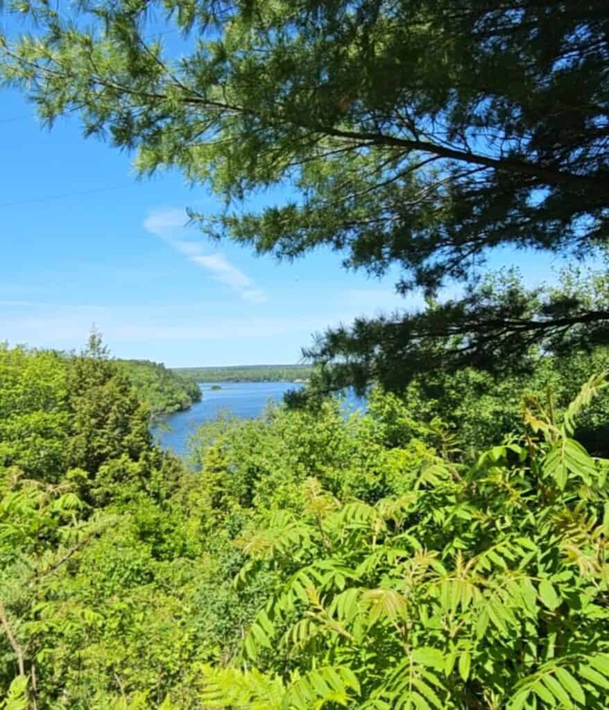
The Au Sable River runs 138 miles from Grayling to Oscoda, and somewhere along that route it stops being a trout stream and becomes the spine of an entire Northern Michigan road trip. I’ve paddled the cold, clear upper water near Grayling and watched the same river pour into Lake Huron at Oscoda, and the stretch in between — six hydroelectric dams, a string of quiet reservoir ponds, and one of the best scenic byways in the state — is the part most people drive past without realizing what they’re missing.
This guide follows the river the way you’d actually travel it, west to east, from the canoe liveries of Grayling down through the dam ponds to the River Road National Scenic Byway and the Lake Huron rivermouth at Oscoda. I’ve covered Michigan’s Sunrise Coast for years, including a Washington Post feature where I named Oscoda Beach Park my pick for the state — and the Au Sable is the reason that corner of Iosco County earns repeat trips. Here’s how to paddle it, drive it, camp it, and where to stop along the way.
📍 At a Glance: The Au Sable River
- 🗺️ Length and route: About 138 miles, originating north of Grayling and emptying into Lake Huron at Oscoda
- 🚣 Best for paddling: The Grayling stretch — crystal-clear water, no rapids, an easy 3–5 mph current ideal for beginners and families
- ⚡ The dams: Six hydroelectric dams — Mio, Alcona, Loud, Five Channels, Cooke, and Foote — built between 1911 and 1924
- 🛣️ Scenic drive: The 22-mile River Road National Scenic Byway near Oscoda, with overlooks at Cooke and Foote dam ponds
- 🎣 Known for: Blue-ribbon trout fishing on the upper river — the famous “Holy Waters” near Grayling
- 🍂 Best months: June–August for water; late September to mid-October for fall color on the byway
Map of the AuSable River from the Oscoda CVB
How to Use This Guide
The Au Sable is really three rivers in one. The cold, fast upper section around Grayling is a paddling and fly-fishing river. The middle section is a chain of lake-like reservoir ponds behind six dams. And the lower section near Oscoda is a scenic-byway river that meets Lake Huron. This guide moves through all three in order, so you can read it as a west-to-east road-trip plan or jump to the section that fits your trip.
If you only have a day, pick one end: paddle from Grayling, or drive the River Road Scenic Byway and beach at Oscoda. If you have a long weekend, do both ends and camp at a dam pond in between. The Quick Picks box below sorts the whole river by what you’re after.
⚡ Quick Picks by Interest
- 🛶 Best Paddling: Grayling liveries (Borchers, Penrod’s), 2–4 hour floats, calm beginner water
- 🍂 Best Scenic Drive: River Road National Scenic Byway, Iargo Springs, Lumberman’s Monument, Foote Pond Overlook
- 🏕️ Best Camping: Alcona Park, Oscoda County Park (Mio Pond), Old Orchard Park, national forest sites
- 🦅 Best Birding: Dam ponds for bald eagles and trumpeter swans; Kirtland’s warbler near Grayling
- 🏖️ Best Family Day: Tube the Oscoda end, then beach at Oscoda Beach Park where the river meets Lake Huron
- 🍽️ Best Meal Stop: Desi’s Family Dining in Oscoda for sit-down Mexican after a day on the water
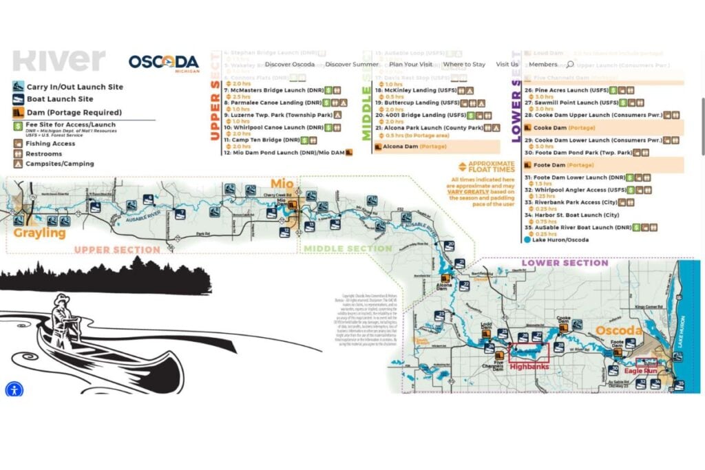
The Six Dams and Ponds of the Au Sable River
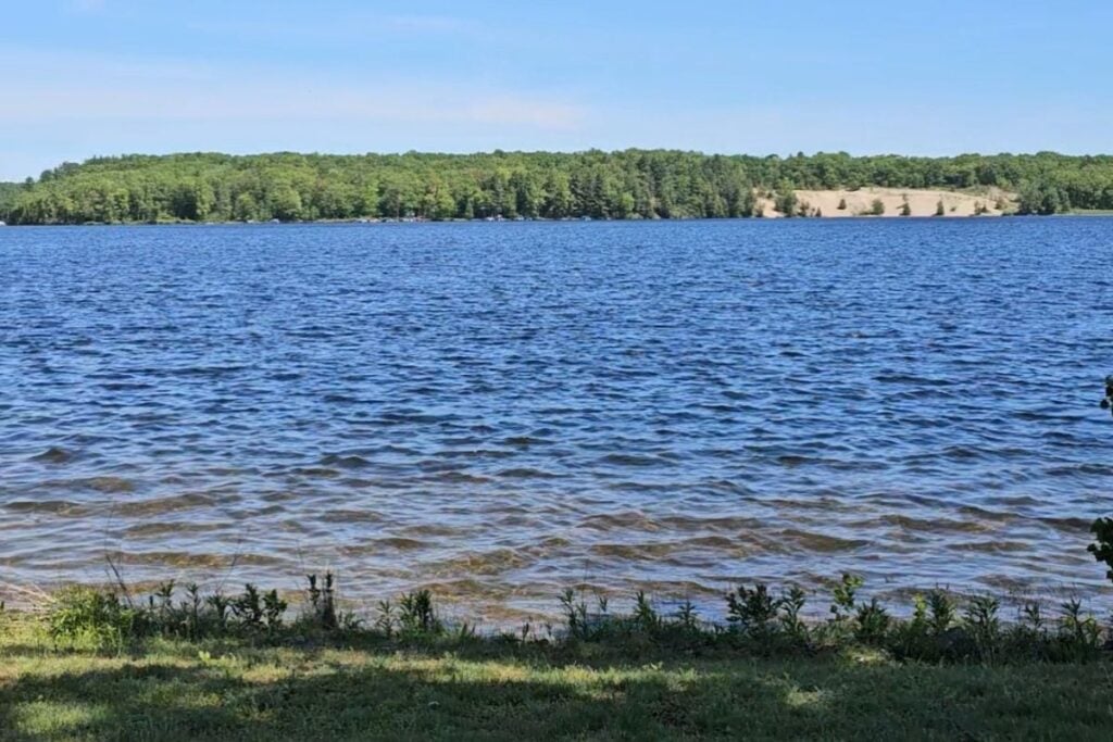
The middle Au Sable is one of the most heavily dammed rivers in Michigan, and the six hydroelectric dams are what give the route its character. Built between 1911 and 1924, they hold back a chain of reservoir ponds that together cover about 10 square miles — slow, lake-like water that’s the heart of the camping, boating, and birding along this stretch. From west to east, the dams run Mio, Alcona, Loud, Five Channels, Cooke, and Foote.
Cooke Dam came first, generating power in December 1911, and it’s listed on the National Register of Historic Places. The two easternmost ponds, Cooke and Foote, are the ones most visitors see, because the River Road Scenic Byway runs right along them. The dams have long been owned by Consumers Energy and are in the process of being sold to a new operator, but the ponds, parks, and overlooks remain open and are the draw here.
| Dam / Pond (west to east) | What’s There |
|---|---|
| Mio Dam | Oscoda County Park; eagle viewing; first under-sluice spillway design |
| Alcona Dam | Alcona Park — 440+ campsites; the big family reservoir camp |
| Loud Dam | Quiet pond, boat access, undeveloped paddling water |
| Five Channels Dam | Remote access point, river access between Bissonette and River Roads |
| Cooke Dam | National Register listed (1911); Sawmill Point; on the scenic byway |
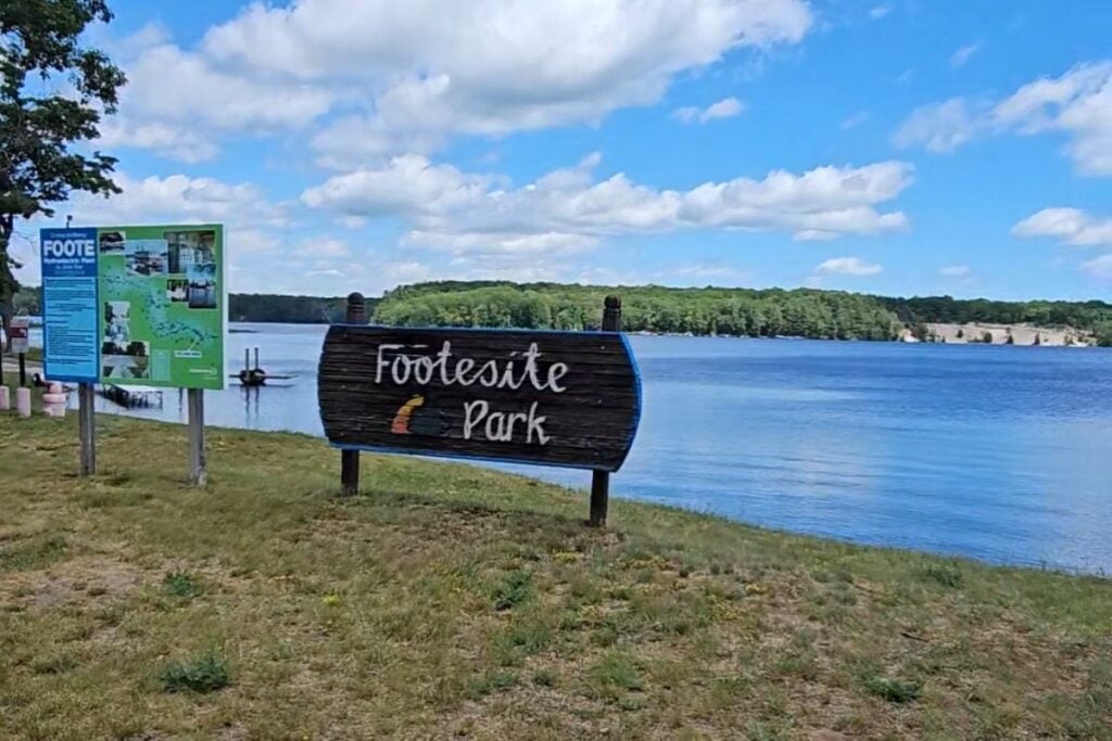
| Foote Dam | Foote Pond Overlook (Champagne Hill); lowest dam; Foote Site Park |
Paddling the Au Sable River from Grayling
The Grayling stretch is the best place to paddle the Au Sable, especially for beginners and families. The upper river runs crystal clear with no rocks or rapids — just an easy 3–5 mph current through forests of pine, birch, and cedar. Grayling calls itself the canoe capital for a reason: this is where the river is most accessible, the liveries are clustered downtown, and the trips range from a relaxed two hours to multi-day camping floats all the way toward Oscoda.
Two family-owned outfitters anchor the Grayling scene, sitting almost side by side on Maple Street right at the river. Both handle the shuttle so you just paddle and float back into town.
- 📍 Borchers AuSable Canoe & Kayak: 101 Maple St, Grayling, MI 49738 | official website
- 📍 Penrod’s AuSable Canoe & Kayak: 100 Maple St, Grayling, MI 49738 | official website
- 🛶 Trips: 2-hour floats up to multi-day camping trips; canoes, kayaks, and tubes
- 💰 Cost: See current rates on each outfitter’s site; reservations encouraged in summer
💡 PRO TIP: The Grayling water is a fly-fishing shrine, not just a float route — the upper main branch is known as the “Holy Waters,” some of the most famous blue-ribbon trout fishing in the country. If you’re paddling on a summer weekend, launch early; you’ll share quieter water with anglers and have the river closer to yourself.
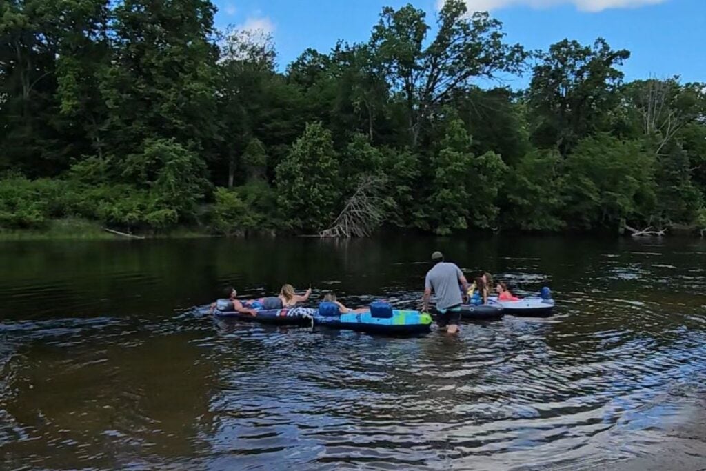
Tubing and Kayaking the Au Sable Near Oscoda
At the Oscoda end, the river is wider and warmer, and it’s the better choice for tubing and a casual paddle near the lake. This is where the Au Sable finishes its run to Lake Huron, and the lower stretch through the Huron-Manistee National Forest has pine-lined banks, sandy pull-outs for lunch, and bald eagles overhead. For most visitors a 2- to 4-hour trip is the sweet spot — long enough to settle in, short enough that kids stay happy.
Oscoda Canoe Rental is the workhorse outfitter at this end, with two trip lengths and shuttle service included. The shorter Whirlpool Launch trip covers about 6 river miles in roughly two hours; the longer Rea Road run covers about 12 miles over four hours. For paddleboards, jet skis, and pontoons closer to the lake, Sunny Bunns handles the broader watercraft inventory.
- 📍 Oscoda Canoe Rental: 678 W River Rd, Oscoda, MI 48750 | official website
- 🛶 Trips: 2-hour (≈6 miles) and 4-hour (≈12 miles) options; canoes, kayaks, tubes
- 📞 Phone: 989-739-9040; reservations encouraged
- 🏄 Also nearby: Sunny Bunns Watercraft Rental for paddleboards, jet skis, and pontoons
The River Road National Scenic Byway
The 22-mile River Road National Scenic Byway is the easiest way to see the lower Au Sable, and it strings together the river’s best overlooks in one afternoon drive. It runs west from Oscoda along the bluffs above the Cooke and Foote dam ponds, twisting through the Huron-Manistee National Forest with pull-offs at nearly every bend. Here are the stops worth building the drive around, heading west from Oscoda.
Lumberman’s Monument
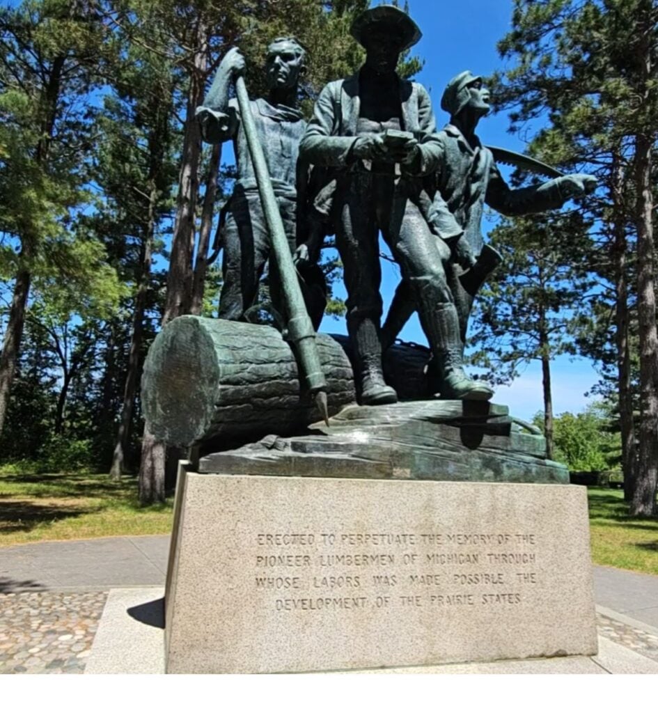
Lumberman’s Monument is the main event on the byway — a 14-foot bronze statue of three pioneer lumbermen on a high bluff above the Au Sable, with a free visitor center and sweeping river-and-dune views. The memorable part is what’s below: roughly 260 wooden steps down the bank to a replica floating lumber-camp cook shack called a wanigan. The descent is easy; the climb back is the part to plan for. If the stairs aren’t realistic, the short, level trail to the Dune Observation Deck delivers nearly the same view with none of the cardio. Read my full guide to Lumberman’s Monument before you go.
- 📍 Address: 5401 Monument Rd, Oscoda, MI 48750 | official website
- ⏰ Hours: Grounds open year-round; visitor center seasonal (Memorial Day to mid-October)
- 💰 Cost: Free
- 📞 Phone: 989-362-8961
- 🐕 Dogs: Welcome on leash on national forest grounds; not inside visitor center buildings
- ♿ Accessibility: Monument, visitor center, and Dune Observation Deck trail accessible without the stairs
Iargo Springs
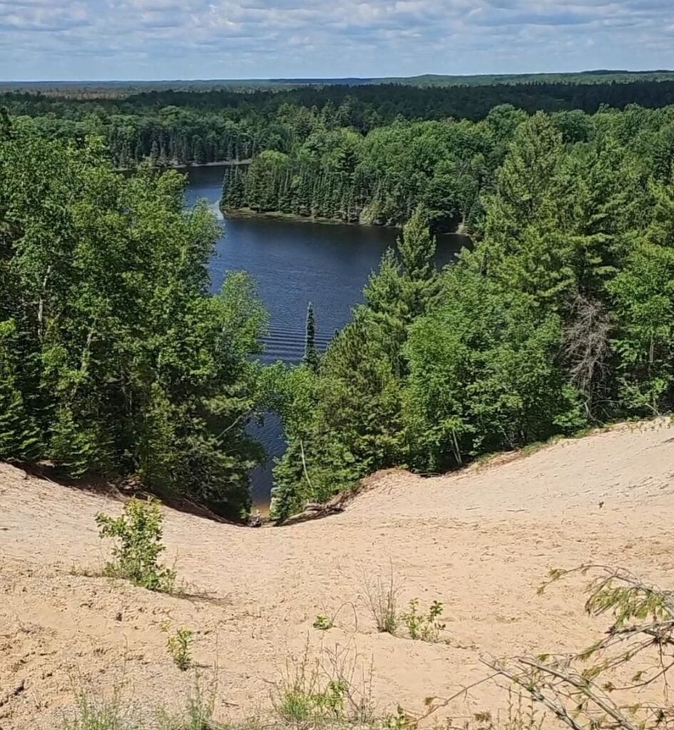
Iargo Springs is the byway’s quietest, most atmospheric stop — cold, crystal-clear springs that bubble from the forest floor and run to the Au Sable over historic man-made dams, reached by a wooden staircase of about 294 steps. At the bottom, more than 1,000 feet of shaded boardwalk wind past spring pools and river-edge decks, and it often feels 10–15 degrees cooler down by the water. The upper observation deck, barrier-free and roughly 300 feet above the valley, is the payoff if the stairs aren’t in your plans. The Highbanks Trail starts right here. My full Iargo Springs guide has directions and tips.
- 📍 Address: 5761 N Skeel Ave, Oscoda, MI 48750 (GPS 44.44133, -83.67587)
- ⏰ Hours: Daily 6 a.m.–10 p.m., year-round
- 💰 Cost: Free; day-use lot with vault toilets
- ♿ Accessibility: Upper overlook deck is barrier-free; springs require the stairs
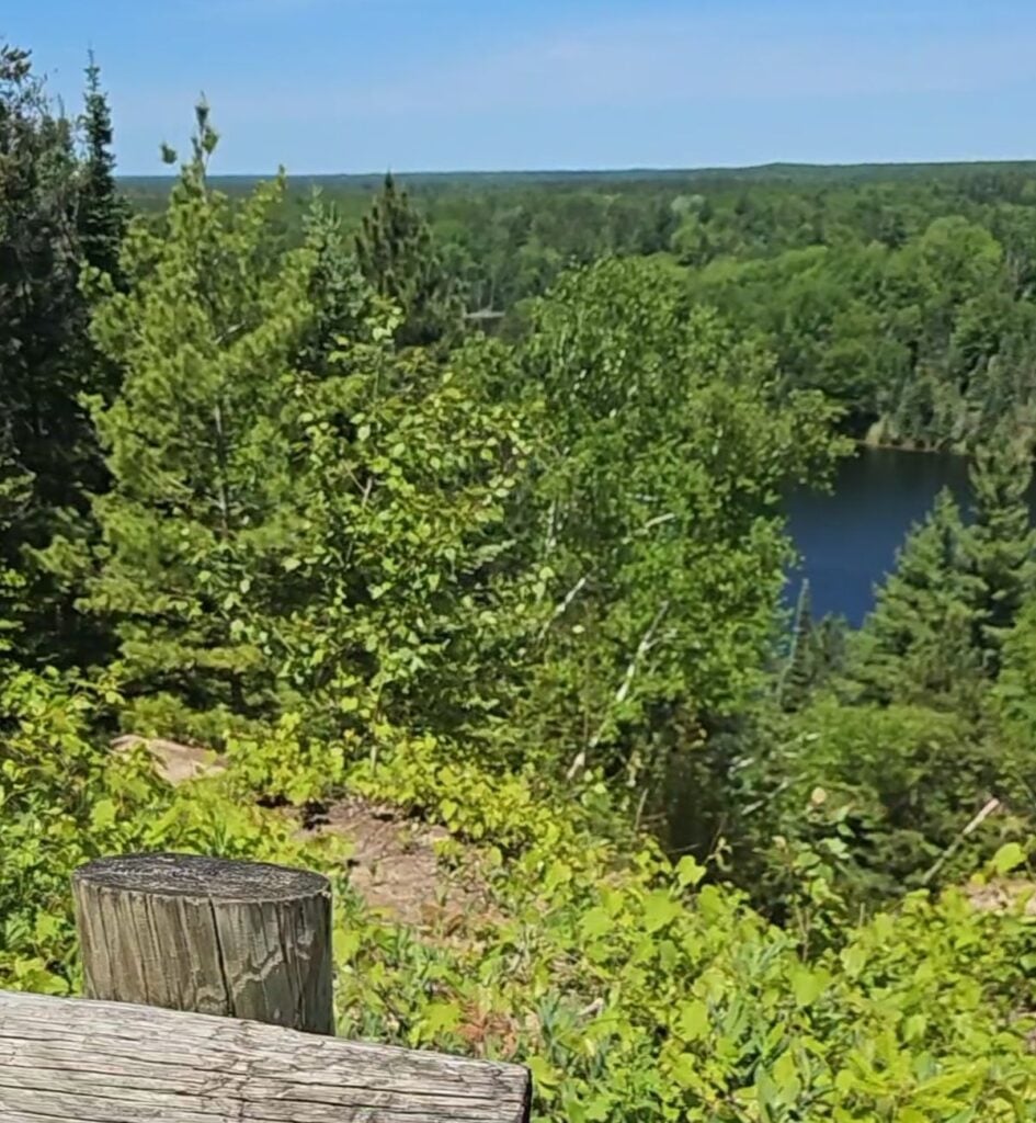
Highbanks Trail
The Highbanks Trail is the byway’s signature hike — a ridge-top path along the bluffs high above the Au Sable, with rolling overlooks of the river valley and the dam ponds below. It starts at Iargo Springs and links several overlooks, so you can walk as much or as little as you like and turn back when you’ve had your fill of views. It’s part of why Oscoda holds an official Pure Michigan TrailTown designation, with forest trails connected straight to in-town food and lodging. In winter it’s hikeable with snowshoes or backcountry skis.
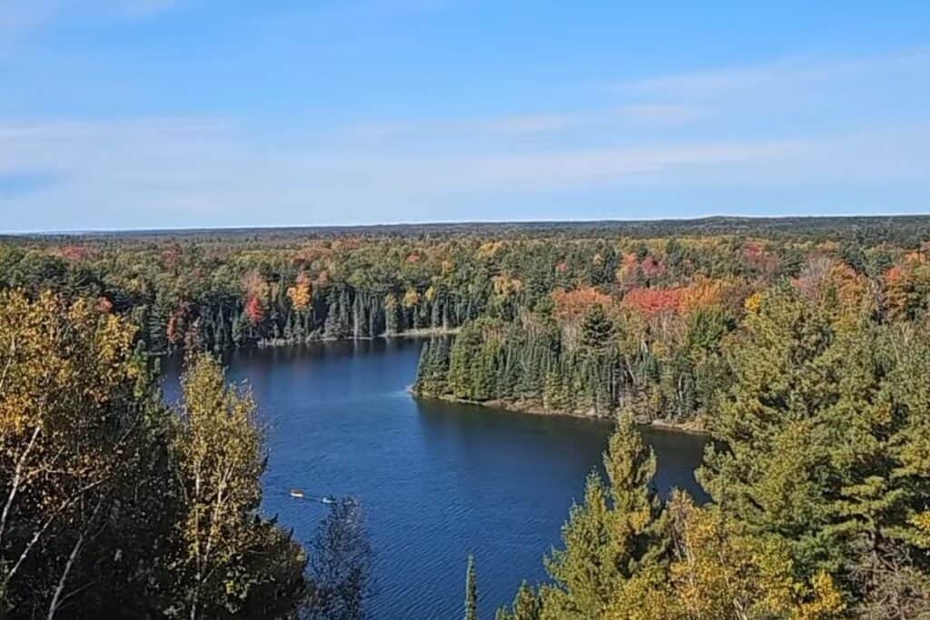
Foote Pond Overlook and Foote Site Park
Foote Pond Overlook is the best sunset stop on the byway — it sits atop a steep sand bluff known as Champagne Hill, with a panoramic view of the Au Sable bending wide below, often packed with boaters and swimmers on a warm weekend. Closer to town, Foote Site Park is the only swimming beach on the byway and the dock for the Au Sable River Queen paddlewheel boat, which makes it a natural lunch stop. The Cooke Dam Pond overlook and the Canoer’s Memorial, honoring the canoe marathon, round out the drive.
Camping Along the Au Sable River
The dam ponds are where most of the river’s camping lives, and they’re the reason the Au Sable works as a multi-day trip. The reservoirs created by the dams give you flatwater for swimming and boating right at your campsite, which is a different experience from the moving water upstream. From west to east, the standout reservoir campgrounds are Oscoda County Park on Mio Pond — a quiet, forested setting with 153 sites and reliable eagle viewing — and Alcona Park on Alcona Pond, a 440-plus-site outdoor complex that’s the big family base on this stretch.
Closer to Lake Huron, the Huron-Manistee National Forest, Old Orchard Park, and Van Etten Lake fill out a deep camping inventory around Oscoda, from rustic forest sites to full-hookup campgrounds. Paddlers running the river from Grayling can also string together riverside national-forest campgrounds for a multi-day float. For the full Oscoda-end breakdown, see my complete guide to camping in Oscoda.
Birding on the Au Sable River
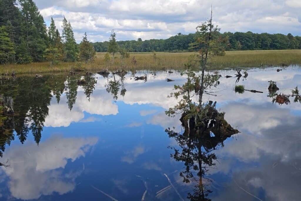
The Au Sable is one of the best birding rivers in the Lower Peninsula, and the dam ponds are the reason. The reservoirs and managed wildlife habitat around the dams support bald eagles year-round and a reintroduced population of trumpeter swans — one December count tallied well over a hundred swans on the Alcona, Cooke, and Foote reservoirs alone. Iargo Springs and the quiet river-edge boardwalks are reliable spots for herons, ducks, and songbirds in the cool shade by the water.
The river’s most famous bird lives up at the Grayling end: the endangered Kirtland’s warbler, which nests in the young jack-pine forests of the northern Au Sable country and almost nowhere else on earth. Spring is the season to look for it, and the Grayling area runs guided tours during nesting season. Spring along the lower river is excellent for migrating songbirds and waterfowl too.

Where to Eat: Desi’s Family Dining in Oscoda
Desi’s Family Dining and Cocktails in Oscoda is the must-visit sit-down stop after a day on the river. It’s an old local favorite for a reason — the eclectic furnishings give the place real character, the kind of room that looks like it has stories, and the Mexican menu is solid and reliable. It’s the right answer when you’ve been on the water all day and want something more substantial than burgers, especially for families and groups. Pair it with coffee and pastries at Sunrise Kava Cafe earlier in the day, or ice cream at Parkside Dairy on the walk back — both are covered in my full Oscoda travel guide.
- 📍 Desi’s Family Dining and Cocktails: Oscoda, MI | Desi’s on Facebook
- 🍽️ Cuisine: Mexican; family- and group-friendly sit-down dining
- ⏰ Hours: Check their Facebook page for current hours before you go
The AuSable River Canoe Marathon
The AuSable River Canoe Marathon is the single best way to understand how completely this river runs Grayling to Oscoda. It’s one of the longest nonstop canoe races in North America — 120 miles, starting in Grayling and finishing in Oscoda, paddled continuously through the night. The race typically runs the last weekend in July. Even if you’re not racing, the finish-line atmosphere in Oscoda is worth experiencing, and the Canoer’s Memorial on the byway honors the paddlers who run it. In 2026, the race starts in Grayling on July 25 and finishes in Oscoda on July 26.
Best Time to Visit the Au Sable River
Summer, June through August, is peak season for paddling, tubing, and camping, with the warmest water and the marathon in late July. But my personal favorite window is late September through mid-October, when the crowds thin out and fall color on the River Road Scenic Byway turns genuinely extraordinary. Iargo Springs in early October, with orange and gold reflecting off the spring pools, is a sight worth driving hours to see.
Spring brings wildflowers, strong birding, and the Kirtland’s warbler tours near Grayling. Winter is quiet but rewarding for the right traveler, with the Highbanks Trail hikeable on snowshoes. Whenever you come, the river rewards an unhurried pace.
Au Sable River FAQ
How long is the Au Sable River?
The Au Sable River runs about 138 miles, originating north of Grayling in northern Michigan and flowing east to empty into Lake Huron at Oscoda. Along the way it passes through the Huron-Manistee National Forest and behind six hydroelectric dams.
How many dams are on the Au Sable River?
There are six hydroelectric dams on the Au Sable River, built between 1911 and 1924. From west to east they are Mio, Alcona, Loud, Five Channels, Cooke, and Foote. The reservoir ponds they create cover about 10 square miles and are popular for camping, boating, and birding. Cooke Dam, the first to generate power in 1911, is listed on the National Register of Historic Places.
Where can I canoe or kayak the Au Sable River?
The two main paddling hubs are Grayling at the upper end and Oscoda at the lower end. Grayling has the clearest, calmest beginner water, served by family outfitters like Borchers and Penrod’s on Maple Street. Near Oscoda, Oscoda Canoe Rental runs 2-hour and 4-hour trips with shuttle service on the wider lower river. Both ends have no rapids and an easy current suitable for families.
What is the River Road Scenic Byway?
The River Road National Scenic Byway is a 22-mile route that runs west from Oscoda along the bluffs above the lower Au Sable River and its Cooke and Foote dam ponds. Its signature stops include Lumberman’s Monument, Iargo Springs, the Highbanks Trail, the Foote Pond Overlook, and Foote Site Park. It’s especially popular in early October for fall color.
Is the Au Sable River good for fishing?
Yes. The upper Au Sable near Grayling is one of Michigan’s designated blue-ribbon trout streams and is famous nationally for fly fishing — the stretch known as the “Holy Waters.” Downstream, the dam ponds and the cool lower river near Oscoda offer additional fishing for a range of species before the river reaches Lake Huron.
Where does the Au Sable River start and end?
The Au Sable River begins north of Grayling in Crawford County, Michigan, and flows generally eastward for about 138 miles before emptying into Lake Huron at Oscoda on the Sunrise Coast. The River Road Scenic Byway and Oscoda Beach Park sit at the rivermouth end, where the river meets the lake.
Plan Your Au Sable River Trip
The Au Sable rewards travelers who treat it as a route, not a single stop. Paddle the Holy Waters at Grayling, camp a dam pond in the middle, drive the byway, and end with your feet in Lake Huron where the river finishes its run. For the lake end of the trip, see my Oscoda travel guide, and for more towns up and down this coast, my guide to the best Lake Huron beach towns covers the whole Sunrise Coast.