
Tahquamenon Falls State Park: A Complete Visitor Guide
Last Updated: August 2026
Tahquamenon Falls State Park holds the second most voluminous vertical waterfall east of the Mississippi — behind only Niagara — and at peak spring runoff the Tahquamenon River pushes 50,000 gallons a second over a drop of nearly 50 feet. It is also Michigan’s second-largest state park, at close to 50,000 acres, and most visitors see only the two overlooks.

I have been coming here in every season for years, and I have covered the Upper Peninsula for WDIV Detroit more times than I can count. This guide covers the fees, the trails worth walking, the accessibility options most people do not know exist, and one shuttle detail that trips up fall visitors every single year.
📍 At a Glance: Tahquamenon Falls State Park
- 📍 Where: 41382 W M-123, Paradise, MI 49768 — about 90 minutes from the Mackinac Bridge
- 🎟️ Entry: Recreation Passport required — $15/year Michigan plates, $42/year or $12/day non-resident
- 🏆 The Upper Falls: Nearly 50-foot drop, over 200 feet wide, up to 50,000 gallons per second at peak runoff
- 🥾 Trails: 35-plus miles, including 16 miles of the North Country Trail
- ♿ Accessibility: Free track chair available to borrow, plus the all-accessible Ronald A. Olson Island Bridge at the Lower Falls
- 🐕 Pets: Leashed dogs welcome on most trails
- 🚐 Shuttle: Runs daily only through Labor Day weekend — see the warning below if you are visiting in fall
Upper and Lower Tahquamenon Falls
Most people are surprised to learn Tahquamenon Falls is not one waterfall. It is two distinct sets along the same river, four miles apart, and they feel like completely different places.
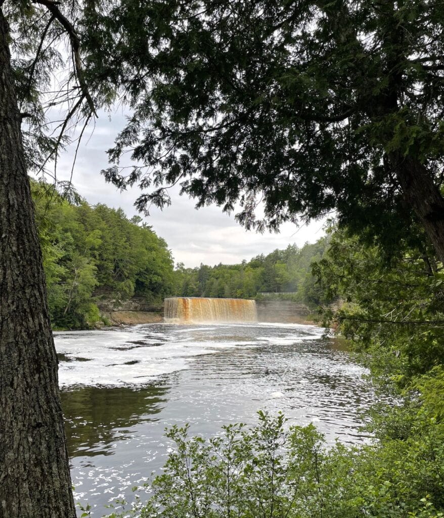
The amber color that everyone photographs comes from tannins leached out of the cedar, spruce, and hemlock swamps the river drains. The water is also extremely soft, which is why the churn at the base throws up so much foam. In sunlight it genuinely looks like root beer, which is where the nickname comes from.
The river itself runs 89 miles from a spring near Newberry to Whitefish Bay on Lake Superior. Henry Wadsworth Longfellow put it in “The Song of Hiawatha” in 1856 — Hiawatha builds his canoe “by the rushing Tahquamenaw” — which makes this one of the few Michigan landmarks with a place in 19th-century American literature.

Experiencing the Upper Falls
A paved path runs roughly four-tenths of a mile from the Upper Falls parking area through old-growth forest to the observation platforms at the crest. That path is accessible, and it gets you to the best view without any real effort.
Beyond the main platforms there is a Brink View that puts you directly above the lip of the falls, watching the water go over and the river bend away below. It is worth the extra effort if you can manage it. Go mid-morning — the light is best before the buses from the Soo arrive.
- 📍 At the Upper Falls: Tahquamenon Falls Brewery & Pub (privately owned), Camp 33 gift shop, the Fact Shack, restrooms, and picnic facilities
- ♿ Accessibility: Paved 0.4-mile path to the crest overlooks
- 💰 Cost: Recreation Passport only — no separate falls admission

Experiencing the Lower Falls
The Lower Falls is quieter — five smaller cascades wrapping around a forested island four miles downstream. You reach the island either by renting a rowboat from the park concession or by crossing the Ronald A. Olson Island Bridge, which is fully accessible.
That bridge matters more than most guides let on. Before it was built, the island was rowboat-only, which put it out of reach for a lot of visitors. Now anyone can get out there and walk the island trails to the south channel view, which is the better angle on the cascades.
This is the family end of the park. Wading in the shallows is allowed here, picnic spots are easy to find, and the Lower Tahquamenon Falls Cafe and Gift Shop is right at the day-use area.

Best Hiking Trails at Tahquamenon Falls
The park has more than 35 miles of trail, and 16 miles of the North Country Trail run through it.
- River Trail (4 miles one-way, moderate to difficult): Connects the Upper and Lower Falls through old-growth forest along the river. Exposed roots, hills, stairs, and muddy or overgrown patches in places. Closed in winter and typically opens in May. This is the signature hike here and it is harder than the mileage suggests.
- Giant Pines Loop (3.8 miles, easy): Ancient white pines, good birding, and gentle enough for families. Doubles as a groomed cross-country ski trail in winter.
- Clark Lake Loop (5+ miles, challenging): Remote peatlands and old dune ridges. For experienced hikers who want to leave the crowds behind entirely.
- Nature Trail (0.5 miles, easy): A short accessible loop with good views, particularly during fall color.
- Lantern Loop (1 mile): Short loop in the Upper Falls area, groomed for skiing in winter.
⚠️ IMPORTANT FOR FALL VISITORS: The standard advice is to park at one falls and take the shuttle to the other for a one-way hike on the River Trail. Hunter Shuttle Service runs daily only through Labor Day weekend — noon to 8 p.m., fee-based, and it does accept dogs. If you are coming for fall color in October, confirm availability before you plan a one-way hike, or you will be walking eight miles instead of four. Call or text 906-291-3422.
Accessibility at Tahquamenon Falls
This is one of the more accessible major natural attractions in Michigan, and the park does not advertise it well enough.
The park has a track chair available to borrow at no cost. It is an off-road electric chair that handles trails, snow, sand, and standing water — terrain a standard wheelchair cannot manage. Ask at the Fact Shack in the Upper Falls area. It goes on a first-come basis, and reservations are possible, so call ahead if it matters to your trip.
Beyond that: the paved path to the Upper Falls crest overlooks is accessible, the Ronald A. Olson Island Bridge at the Lower Falls is fully accessible, and the short Nature Trail is manageable for most visitors. The steps down toward the base of the Upper Falls and the River Trail between the two falls are not.

Tahquamenon Falls by Season
- Spring: Peak runoff, which is when the 50,000-gallons-per-second figure actually happens. The falls are at their loudest and most powerful in late April and May. Birding is excellent.
- Summer: Rowboat rentals at the Lower Falls, wading in the shallows, and the shuttle running daily. Busiest season and the only one where the one-way River Trail hike is straightforward.
- Fall: The eastern Upper Peninsula peaks in the first two weeks of October, and amber water against gold birch and red maple is the best color-and-water combination in the state. See the Michigan peak fall colors guide for timing.
- Winter: Four miles of groomed cross-country ski trail in the Upper Falls area, snowshoeing throughout, and snowmobile trails running right to the falls. A partly frozen Upper Falls is worth the drive on its own. Dog sledding is available nearby through Nature’s Kennel in Newberry.
Food, Souvenirs, and What’s Nearby
The Tahquamenon Falls Brewery & Pub at the Upper Falls is one of very few sit-down meals for miles. The building is a replica of Camp 33, the logging camp that stood here, with a large deck and a fireplace. Order the locally caught whitefish or a pasty — this is the right place for both.
Within easy reach: Whitefish Point and the Great Lakes Shipwreck Museum, which pairs naturally with the falls on the same trip; the Tahquamenon Logging Museum in Newberry; and Oswald’s Bear Ranch, a rescue sanctuary that families tend to love.
💡 PRO TIP: Arrive before 10 a.m. or after 4 p.m. to miss the crowds, wear real shoes, and bring bug spray — this is a cedar swamp and the mosquitoes in June are not a joke. Cell coverage is limited, so download your maps before you leave Newberry or Paradise.
Tahquamenon Falls: Questions & Answers
How much does it cost to visit Tahquamenon Falls?
Entry requires a Michigan Recreation Passport on your vehicle. As of 2026 that is $15 a year for Michigan-plated vehicles purchased at license plate renewal, or $42 a year and $12 a day for out-of-state plates. There is no separate admission for the falls themselves.
Is Tahquamenon Falls wheelchair accessible?
Substantially, yes. The paved path from the Upper Falls parking area to the crest overlooks is accessible, and the Ronald A. Olson Island Bridge at the Lower Falls is fully accessible. The park also lends a free off-road track chair that handles trails, snow, sand, and standing water — ask at the Fact Shack. The steps to the base of the Upper Falls and the River Trail between the falls are not accessible.
How long is the hike between the Upper and Lower Falls?
The River Trail runs about four miles one way through old-growth forest along the river. It is rated moderate to difficult with exposed roots, hills, and stairs, and it typically opens in May after being closed for winter. A fee-based shuttle runs between the two falls daily through Labor Day weekend, which makes a one-way hike possible in summer.
Can I swim at Tahquamenon Falls?
Wading is allowed in the shallows at the Lower Falls, which is where families spend warm afternoons. Swimming is not permitted at the Upper Falls.
Are dogs allowed at Tahquamenon Falls?
Yes, leashed dogs are welcome on most trails in the park. The shuttle between the two falls also accepts dogs, which is unusual and useful if you are hiking the River Trail one way.
Are drones allowed at Tahquamenon Falls?
No. Drone use is prohibited throughout the park.
Planning Your Visit
Most visitors see the two overlooks and drive on, which is a shame in a park this size. Give it a full day, walk at least part of the River Trail, and cross to the island at the Lower Falls.
Pair it with Whitefish Point for a strong Upper Peninsula weekend, or work it into a wider UP road trip. And if fall color is the plan, check the shuttle first.
- About Jill
- Recent Michigan Travel Tips

Jill Halpin is a Michigan travel expert and founder of MyMichiganBeach.com. She has been sourced by The Washington Post and featured in The Detroit News and Detroit Free Press, and appears regularly on WDIV Detroit, FOX 2 Detroit, FOX 17 West Michigan, FOX 32 Chicago, WGN Chicago, and NewsNation — 60+ television appearances to date. She holds an MLIS from Wayne State University and is a Library of Congress Information Science Fellow. See all media features.