
The AuSable River in Fall: Where to See the Color, Paddle, Fish and Camp in Michigan
Last updated: September 2026

Michigan’s AuSable River in fall is the best argument I know for Northern Michigan in October: more than 120 miles of river running from Grayling east to Lake Huron at Oscoda, with gold hardwoods on the bluffs, salmon pushing upstream below Foote Dam, and paddlers who suddenly have the whole river to themselves. You’ll see it spelled Au Sable too, and locals use both.
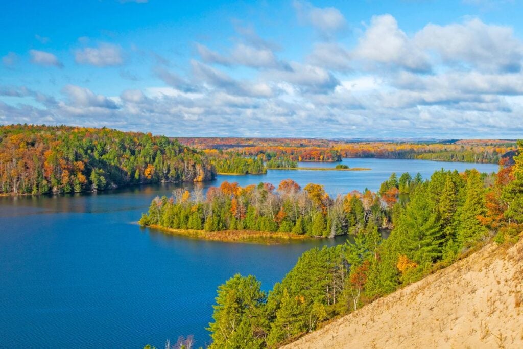
This guide is for you if you want to drive it, paddle it, fish it, or camp beside it before the snow flies. I’ve spent enough time on the Discover Iosco County Travel Board to know which stretches earn the drive in fall, and which details the older guides still get wrong, including this year’s closure of Iargo Springs starting October 1.
At a Glance: The AuSable River in Fall
- Peak color near Oscoda: Usually early to mid-October along the river valley.
- Easiest way to see it: The River Road National Scenic Byway, about 22 miles from Oscoda west to M-65.
- Closing October 1: Iargo Springs, for a renovation expected to last through 2027. It’s open through September 30.
- Best single stop in October: Lumberman’s Monument, free, with the statue, grounds, and river overlook.
- Best fall paddle: Foote Dam to Oscoda, about 12 miles and four hours.
- Fall fishing: Salmon below Foote Dam, plus year-round fly fishing on the Holy Water near Grayling.
- Dogs: Welcome on the national forest, on a leash of six feet or less at developed sites and trails.
- Drive time: Oscoda is about 3.5 hours from Detroit; Grayling is about 3 hours from Detroit and 5 from Chicago.
The AuSable Is Really Three Rivers in One
The first thing to understand is that the Au Sable changes character completely as it moves east. Near Grayling, in Crawford County, it’s a clear, shallow trout stream famous among fly anglers. From Mio to Oscoda, six hydroelectric dams turn it into a chain of wide ponds that look more like lakes. Below Foote Dam, the last nine or so miles become a Great Lakes tributary where salmon and steelhead run in from Lake Huron.
That’s why “visiting the Au Sable” means picking an end. Grayling and Oscoda sit about an hour and a half apart, and each gives you a different river. One more local mix-up worth knowing: the town of Oscoda is in Iosco County, while Mio is the seat of Oscoda County. Map apps won’t warn you.
Quick Picks by Interest
- Color chasers: River Road west from Oscoda, stopping at Foote Pond Overlook, Lumberman’s Monument, and the Canoer’s Memorial.
- Last-chance visitors: Iargo Springs before it closes on October 1.
- Paddlers: The Foote Dam to Oscoda float for scenery, or the upper river out of Grayling for shallow, clear water.
- Anglers: Salmon below Foote Dam in September and October, or the flies-only Holy Water near Grayling.
- Birders and non-anglers: A guided eco-float out of Grayling, with no fishing gear on board.
- Families: Lumberman’s Monument grounds and the short, two-hour Whirlpool float.
- Free: Lumberman’s Monument, the Canoer’s Memorial, and the other River Road overlooks.
Dog-Friendly and Accessible AuSable River Stops
Dogs are welcome across the Huron-Manistee National Forests. The Forest Service’s rules for dogs require a leash of six feet or less at developed recreation sites, including their trails, and keep dogs out of designated swimming areas. In fall, put a blaze orange vest on your dog and yourself, since hunters share these woods and Michigan’s archery deer season opens October 1.
For accessibility, Whirlpool Angler Access, just west of Oscoda, has an accessible fishing ramp. Across the river on the AuSable side, Piety Hill has an accessible fishing pier. Lumberman’s Monument and Iargo Springs both involve long stairways to the water, so plan on the overlooks if stairs are a barrier.
When Is Peak Fall Color on the AuSable River?
Near Oscoda, peak color usually lands in early to mid-October, according to the Oscoda Area Convention and Visitors Bureau’s fall page. The river valley turns before the Lake Huron shoreline, and the upper river around Grayling generally runs a little ahead of the lakeshore.
Here’s what I’d do: aim for a weekday in the first half of October, and check my live Michigan fall color report the week before you go. Late September is my quiet pick this year, because you trade some color for warmer paddling weather, empty overlooks, and one last look at Iargo Springs before it closes.
Driving River Road: The Easiest Way to See the AuSable in Fall
If you only have a day, drive the River Road National Scenic Byway. It runs west from US-23 in Oscoda along the river’s bluffs through the Huron National Forest to M-65, and every overlook along it is free.
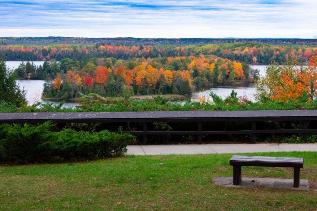
I love driving River Road west all the way to its end at M-65, and I stop at the pull-offs every time. My usual list is Foote Pond Overlook, Champagne Hill, Lumberman’s Monument, and Iargo Springs. Between Lumberman’s Monument and Iargo Springs, the Canoer’s Memorial looks out over Cooke Dam Pond and honors the racers in the Au Sable River Canoe Marathon, which has run 120 miles from Grayling to Oscoda each July since 1947.
From October 1, swap Iargo Springs for a longer stop at Lumberman’s Monument and the Canoer’s Memorial. Fill your tank in Oscoda before you head west. There’s no gas along the byway, cell service fades in stretches of the forest, and the overlooks have vault toilets with no drinking water. My full fall in Oscoda guide covers every pull-off and a two-day plan for town.
Iargo Springs: Open Through September 30
Iargo Springs closes on October 1, 2026, for a renovation expected to last through 2027. The Forest Service has confirmed the closure, and the Oscoda Area CVB’s Iargo Springs page lists the dates. If you can get here before then, it’s the stop to build your drive around, especially on a sunny day.
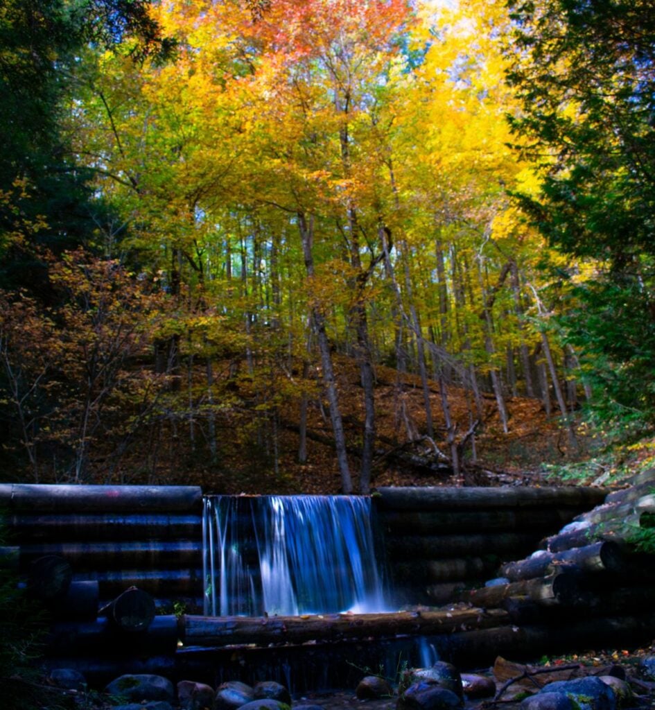
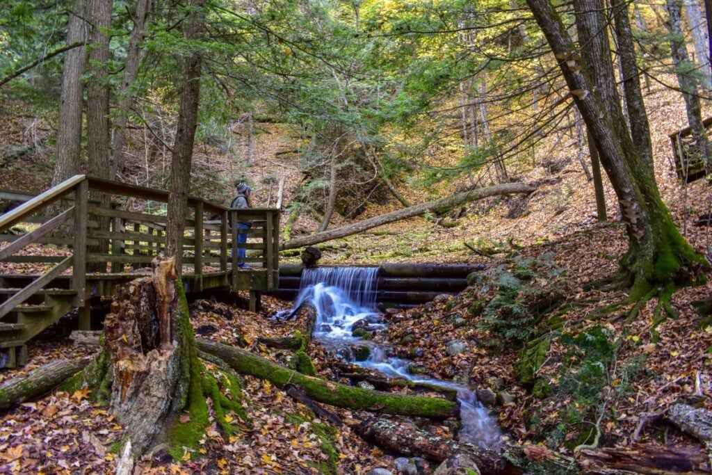
Roughly 300 wooden steps drop from a bluff-top overlook to boardwalks where springs run down to the river through small, rebuilt logging-era dams. The stairs are hard, and it’s worth it even if you don’t make it to the bottom. A few flights down, you’re surrounded by lush forest, the smell of fresh water, and the sound of the springs, and the whole place feels pristine. At the bottom, a platform stretches out over the Au Sable, and on a clear day the water reflects the sky so perfectly it becomes its own Lake of the Clouds. The air is noticeably cooler down there, and the climb back up is a workout.
Quick Facts: Iargo Springs
- Status: Open through September 30, 2026; closed for renovation starting October 1, with construction expected through 2027
- Where: River Road National Scenic Byway, west of Lumberman’s Monument (GPS 44.4414, -83.6761)
- Cost: Free
- Parking: About 20 vehicles
- Facilities: Vault toilets; no drinking water
- More: Forest Service Iargo Springs page
My Iargo Springs walkthrough has more on the stairs, the closure, and the best light for photos.
Lumberman’s Monument and the Highbanks Trail
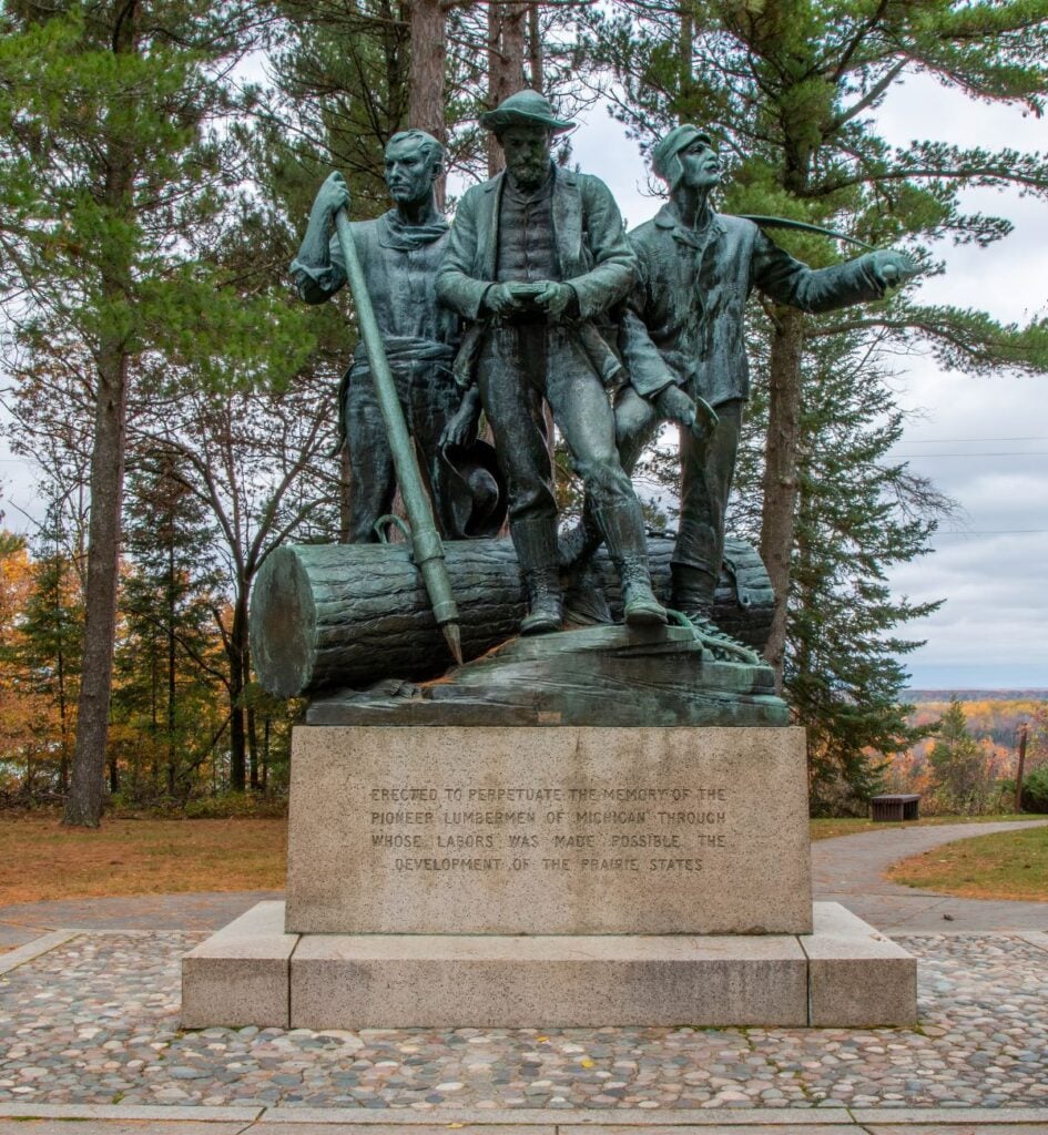
Lumberman’s Monument is the family stop, and the best place to understand why this river mattered. The 14-foot bronze statue honors the loggers who floated timber down the Au Sable, and it stands on a high bank with the river spread out below. With Iargo Springs closed from October 1, this is the stop to build an October drive around.
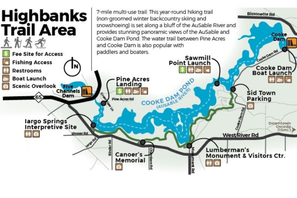
The monument itself is interesting, but the grounds are just as beautiful to explore, and I always recommend walking the stairs down toward the river. From here, the Highbanks Trail follows the bluff for about seven miles, with river views that are at their best when the hardwoods turn. In October, start from Lumberman’s Monument and follow any posted signs near Iargo Springs, where construction may affect the western end of the trail.
Quick Facts: Lumberman’s Monument
- Address: 5401 Monument Rd, Oscoda, MI 48750
- Cost: Free
- Visitor center: Open seven days a week from May through Labor Day in 2026; call (989) 362-8961 for fall hours
- More: Forest Service Lumberman’s Monument page
Why the visitor center hours matter: the Forest Service’s seven-day schedule was announced only through Labor Day, so if the logging exhibits are the reason you’re going, call before you drive out. The statue, overlook, and grounds don’t depend on the building being open. My Lumberman’s Monument guide covers the exhibits and trails in detail.
Can You Paddle the AuSable River in Fall?
Yes, and September into early October is one of the nicest times to do it, with cooler air, fewer tubers, and color on the banks. The catch is that liveries run shorter fall schedules, so call ahead instead of assuming summer hours.
The Oscoda End: Foote Dam and Whirlpool Floats
This is the paddle I’d pick for a fall color weekend on the Sunrise Coast. Oscoda Canoe Rental, a half mile west of US-23 on River Road, runs two trips back to its dock: about six miles and two hours from Whirlpool, or about 12 miles and four hours from Foote Dam. Its listing on Michigan.org says the livery operates through October, and the phone number is (989) 739-9040.
If you have the time, take the longer Foote Dam trip. It gives you more forested river before the town section, and in fall that’s where the color is.
Pro tip: Oscoda Canoe Rental requires one-day canoes and kayaks to be off the river by 6 p.m. under Forest Service rules. In October, that means taking the first launch you can get for the four-hour trip, and packing a dry layer, because the water is cold even when the afternoon feels warm.
The Grayling End: The Upper River
Near Grayling, the Au Sable is shallower, narrower, and clear enough to watch the sand and gravel slide by under your boat. Penrod’s Au Sable Canoe and Kayak sits right on the river at 100 Maple St, Grayling, MI 49738, and runs trips downstream toward Burton’s Landing and Stephan Bridge.
Penrod’s posts full daily hours only from Memorial Day through Labor Day. For September to mid-October, it asks you to call for availability, so don’t show up on a Saturday in October expecting a boat without phoning first.
A Guided Float Without the Fishing
If you’d rather sit back and watch the banks, Au Sable River Guide Service’s eco tours out of Grayling take one or two guests down the Au Sable or Manistee with no fishing gear on board. The guide pitches them to birders during spring and fall migration, and you don’t need a fishing license. Posted rates are $350 for a half-day and $450 for a full day, and the guide service is on (248) 495-2615.
For more paddling around the state, my guide to kayaking in Michigan covers other rivers worth a fall trip.
Fishing the AuSable River in Fall
Fall splits the Au Sable into two very different fisheries: trout on the upper river near Grayling, and salmon on the lower river below Foote Dam. Regulations change every April 1 and vary by stretch, so check the current Michigan fishing regulations for the exact reach you plan to fish.
The Holy Water Near Grayling
The Holy Water runs from Burton’s Landing to Wakeley Bridge east of Grayling, and it’s the most famous trout water in the state. It’s open to fishing year-round, but only with artificial flies, and trout can’t be kept, except that children under 12 may keep one. That matters in fall, because many Michigan trout streams close after September, while this stretch stays open.
If you’re new to fly fishing, Au Sable River Guide Service offers guided trips and casting lessons from Grayling and says it works with beginners, women, and youth anglers.
Salmon Below Foote Dam
Foote Dam stops fish moving up from Lake Huron, so the river between the dam and Oscoda is where the fall run concentrates. In recent Septembers, the DNR’s reports have noted coho and Chinook salmon entering the lower river and being caught at Foote Dam, along with Atlantic salmon. The DNR weekly fishing report is the best way to see what’s moving the week you go.
Before you keep anything, know this: Michigan health officials recommend not eating “resident” fish, meaning fish that live in the river year-round, taken from the Au Sable below Foote Dam to Lake Huron. Migrating fish from the lake aren’t part of that recommendation, but check the state’s Eat Safe Fish guides before you cook your catch.
Quick Facts: Whirlpool Angler Access
- Where: Lower Au Sable River west of Oscoda (GPS 44.4319, -83.3908)
- Cost: $5 per vehicle per day or $15 for seven days; pay on-site with cash or check, or buy online in advance
- Accessibility: Accessible fishing ramp
- Facilities: Vault toilets, parking for about 35 cars and 32 vehicles with trailers; no drinking water
- More: Forest Service Whirlpool Angler Access page
Camping Along the AuSable River in Fall
The lower river has something most Michigan rivers don’t: individually designated riverside campsites spread along the shore and bluffs in the national forest, many of them easiest to reach by canoe. Fall is a lovely time to use them, with cool nights and no bugs.
Two rules to know before you go. Campfires aren’t allowed within 200 feet of the water, a swamp, or a foot trail except at designated campsites. And permit requirements depend on the season, so check the Au Sable River backcountry campsite page for the current rules before an overnight trip. If you’d rather have a drive-up site, my Oscoda camping guide and favorite fall campgrounds in Michigan cover the options.
What Older AuSable River Guides Get Wrong
A lot of fall itineraries for this river are copied forward year after year. Here’s what’s changed.
- Iargo Springs closes October 1, 2026. The Forest Service has confirmed the renovation closure, which is expected to last through 2027, so skip it on any October itinerary that still lists it.
- The AuSable River Queen isn’t running. The paddlewheel boat sank at its dock in March 2025 and was removed from Foote Site Pond that August, so don’t plan a fall color cruise around it.
- Lumberman’s Monument Visitor Center hours shrink after summer. The seven-day schedule was announced through Labor Day, so call before visiting in fall.
- Fish from the lower river come with a warning. The “do not eat” recommendation for resident fish below Foote Dam rarely makes it into fishing roundups.
What I’d Do With a Fall Weekend on the AuSable
Saturday: Start with coffee in Oscoda, then drive River Road west in the morning with the sun behind you. Stop at Foote Pond Overlook, walk the grounds at Lumberman’s Monument, and take in Cooke Dam Pond from the Canoer’s Memorial. If it’s still September, add the stairs at Iargo Springs while the light is on the water. Keep going to M-65 if you want the whole byway, then head back to town for dinner.
Sunday: Book the four-hour Foote Dam float for the earliest launch you can get, or spend the morning on the lower river if you fish. Finish on the Lake Huron beach in Oscoda, where the water often stays warm enough to swim through the end of September. If you’d rather base yourself in Grayling, swap in a float from Penrod’s or a guided eco tour and save River Road for the drive home.
Where to Stay for a Fall Trip on the AuSable
For the Oscoda end, stay close to the river mouth so you can reach both River Road and the beach in minutes. My guide to where to stay in Oscoda for fall color lists lakefront cottages, resorts, and hotels with direct booking links. For more to do in town, the Oscoda travel guide fills in restaurants, beaches, and history.
The Michigan Traveler
Fall on the Au Sable moves fast: one week the maples are green, the next they’re peaking, and by the end of October the liveries have pulled their boats. I send out what’s actually turning, what’s still open, and where to go that weekend. Come along.
Frequently Asked Questions
Is Iargo Springs open in October 2026?
No. Iargo Springs is open through September 30, 2026, then closes for a renovation expected to last through 2027. Lumberman’s Monument and the other River Road overlooks stay open.
Is it Au Sable or AuSable?
Both. The U.S. Forest Service and the Michigan DNR generally use “Au Sable,” while many Oscoda businesses, the township, and local signs use “AuSable.” They refer to the same river.
Where does the AuSable River start?
The AuSable River starts in the Grayling area in Crawford County and flows east to Lake Huron at Oscoda in Iosco County. The AuSable River Canoe Marathon covers 120 miles of it each July.
Do you need a pass to visit the AuSable River sites?
Not at the most popular stops. Lumberman’s Monument is free, and so is Iargo Springs when it’s open. Some river access sites charge a day-use fee, including Whirlpool Angler Access at $5 per vehicle per day.
When do AuSable River canoe liveries close for the season?
It varies. Oscoda Canoe Rental’s Michigan.org listing says it runs through October, while Penrod’s in Grayling takes September to mid-October trips by availability. Call before you go in fall.
Can you bring dogs to the AuSable River?
Yes, on national forest land. Dogs must be on a leash six feet or shorter at developed recreation sites and their trails, and they’re not allowed in designated swimming areas. Dress them in blaze orange during hunting season.
Before You Go
Pick your end of the river and fill the tank. If you can make it before October 1, get to Iargo Springs on a sunny morning while the water still holds the sky. When you’re ready for the rest of the coast, my best Northern Michigan fall color drives will give you a reason to come back next October.
- About Jill
- Recent Michigan Travel Tips

Jill Halpin is a Michigan travel expert and founder of MyMichiganBeach.com. She has been sourced by The Washington Post and featured in The Detroit News and Detroit Free Press, and appears regularly on WDIV Detroit, FOX 2 Detroit, FOX 17 West Michigan, FOX 32 Chicago, WGN Chicago, and NewsNation — 60+ television appearances to date. She holds an MLIS from Wayne State University and is a Library of Congress Information Science Fellow. See all media features.