
15 Best Fall Color Drives in Northern Michigan and the UP
Last Updated: August 2026
The best fall color drives in northern Michigan and the Upper Peninsula run from the Lake Superior shore down to the Lake Huron coast, and the fifteen below are the ones I actually make. Two of them have significant changes in 2026 — a washed-out section of M-119 and a Sundays-only schedule at Copper Peak — so read the advisories before you plan a long drive around either.
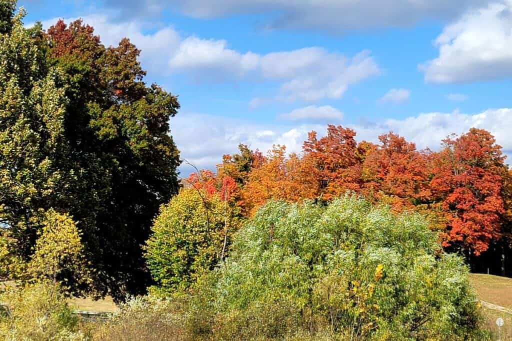

🚗 At a Glance: Michigan Fall Color Drives
- 🏆 Most famous: M-119 Tunnel of Trees — 20 miles, Harbor Springs to Cross Village, with two sections closed to through traffic in 2026
- 🥇 Best overall: M-22 — 116 miles, Manistee north around the Leelanau Peninsula, voted the nation’s best autumn drive by USA Today 10Best readers
- 🏔️ Best elevated view: Brockway Mountain Drive, 9.5 miles above Copper Harbor on the Keweenaw
- 🤫 Least crowded: The US-23 Sunrise Coast route along Lake Huron — 200 miles and a fraction of the traffic
- ♿ Most accessible: River Road Scenic Byway near Oscoda — most overlooks have barrier-free access
- 📅 Timing: UP drives late September to early October; northern Lower Peninsula the second and third weeks of October
How to Use This List
These are grouped by region, running roughly in the order the color arrives. The Upper Peninsula turns first, in the last days of September. Northern Lower Michigan follows in the second and third weeks of October. The Lake Huron side runs on the same timing as the Lower Peninsula but with far fewer cars on the road.
Do not try to chain these together in one trip. Ironwood to Oscoda is a nine-hour drive. Pick one region, give it a full day or a weekend, and use the Michigan fall color map to check conditions before you commit. Peak color predictions are estimates built on weather, and they shift by a week either direction most years.
⚡ Quick Picks by Interest
- ⏱️ Best short drive: Pierce Stocking Scenic Drive (7.4 miles), Brockway Mountain (9.5 miles)
- 🗓️ Best full-weekend route: M-22 from Manistee to Northport, broken into four segments
- 🍎 Best food stops: Pond Hill Farm and the Good Hart General Store on M-119, Art’s Tavern in Glen Arbor, Martha’s Leelanau Table in Suttons Bay
- 🗼 Best lighthouse drives: Point Betsie on M-22, Tawas Point on US-23, Au Sable Light on H-58
- 💧 Best water views: M-2 along northern Lake Michigan, Brockway Mountain over Lake Superior, US-23 along Lake Huron
- 🚶 Best drive plus hike: H-58 through Pictured Rocks, Empire to Glen Arbor with the Empire Bluff Trail

Fall Color Drives in the Upper Peninsula
1. M-2 from Brevort to Naubinway
The northern shore of Lake Michigan is the most underrated stretch of coast in the state. Cross the Mackinac Bridge, head west, and you are on it immediately — no detour required, which is why this is the easiest UP drive to add to a trip that was going somewhere else.
Just past Brevort you reach the Cut River Bridge, a cantilevered steel span over the Cut River Valley and one of the better scenic overlooks in Michigan. Pull over. There are stairs down into the gorge if you want to see the bridge from underneath, which is the version most people never bother with. Continue toward Naubinway, and just past Epoufette there is a second overlook worth the stop.

2. H-58 Through Pictured Rocks: Hurricane River to Twelvemile Beach
Pictured Rocks National Lakeshore runs 42 miles along the southern shore of Lake Superior — painted sandstone cliffs, waterfalls, dunes, and hardwood forest. Pick up H-58 in Grand Marais and follow it west.
The stretch from the Hurricane River Campground to Twelvemile Beach is my favorite color drive in the Upper Peninsula. Stop at the Au Sable Light Station — one of the best Lake Superior lighthouses — and the Lake Superior Overlook.
💡 PRO TIP: Pack hiking shoes. The Au Sable Light Station is a 1.5-mile walk from the Hurricane River lot, and half the reason to drive H-58 is the trailheads you pass. This is not a drive-through-and-photograph route.

3. Black River National Forest Scenic Byway
This Pure Michigan byway in the western Upper Peninsula is the quietest good color drive in the state. It runs north from Bessemer to Black River Harbor on Lake Superior, passing a string of waterfalls along the way, and it holds up whether you catch peak or the shoulder weeks either side.
Halfway along you reach Copper Peak — the only ski flying hill in the Western Hemisphere, with a chairlift and an 18-story elevator to an observation deck looking over roughly 2,500 square miles. On a clear day you can see three states and Lake Superior.
⚠️ 2026 ADVISORY: The Copper Peak Adventure Ride runs Sundays only in 2026, 9:30 a.m. to 4:30 p.m. Central, because of the ongoing reconstruction of the landing hill. Ironwood is nine hours from Detroit — do not make that drive on a Saturday expecting to ride up.
You are just southwest of the Porcupine Mountains here, so add the drive up to Lake of the Clouds while you are this far west. It is the best single view in Michigan and the overlook has an accessible boardwalk.

4. Brockway Mountain Drive
At the tip of the Keweenaw Peninsula above Copper Harbor, Brockway Mountain Drive climbs 9.5 miles to the highest paved road between the Rockies and the Alleghenies. Lake Superior on one side, an unbroken sea of color on the other.
Go at either end of the day. Midday flattens the light and washes out the water, and this is the one drive on this list where the timing genuinely changes the photograph. Note that Copper Harbor at the very tip peaks slightly later than areas nearer the Portage Canal.

Fall Color Drives in Northern Michigan
5. M-119 Tunnel of Trees Scenic Heritage Route
The Tunnel of Trees is 20 miles of M-119 running north from Harbor Springs to Cross Village, hugging the Lake Michigan bluffs under a canopy so low and close the road carries no centerline. It is the best-known fall drive in Michigan.
⚠️ 2026 ROAD ADVISORY: April flooding washed out two sections of M-119. The road is closed to through traffic between Terpening Road and Robinson Road near Good Hart, and again between Island View Road and Cross Village. From Harbor Springs, detour via Terpening to Stutsmanville, right on Townline/Church, left on Robinson to rejoin at Good Hart. For Cross Village, take State Road north instead. Check the Petoskey Area closure page first.
The stops are the point. Pond Hill Farm is one of my favorite cider mills and pumpkin farms. The Good Hart General Store is worth pulling over for — get the chocolate shop cookies for the road. And Legs Inn in Cross Village serves the best smoked kielbasa in Michigan.
One timing note on Legs Inn: the 2026 season runs through October 18 and they are closed Tuesdays. Peak color here lands the second and third weeks of October, so if dinner there is part of your plan, the window is tight. There is also no fuel and there are almost no public restrooms along the tunnel itself.

6. Old Mission Peninsula
Old Mission Peninsula runs 18 miles north out of Traverse City, splitting Grand Traverse Bay into East and West Bay. You are surrounded by water the entire way, with vineyards turning gold on both sides.
Some of the best wineries in Michigan are on this peninsula, and several have rooms if you want to make it a weekend rather than an afternoon. Drive all the way to the tip for the Old Mission Lighthouse and walk the grounds.

7. M-22 Scenic Highway — The Full Route
M-22 runs 116 miles from Manistee north around the Leelanau Peninsula, hugging the Lake Michigan coast through national forest and Sleeping Bear Dunes. USA Today 10Best readers voted it the best autumn drive in the country, beating Skyline Drive in Virginia and Colorado’s West Elk Loop.
It is too long for one good day. The three segments below break it into drives you can actually enjoy.

8. M-22 Segment One: Manistee to Frankfort
Start in Manistee, where the downtown has art galleries, an old-fashioned theater, and good boutiques. Lighthouse Park and Magoon Creek Park both sit on your way north.
Climb the stairs at Inspiration Point in Arcadia for sweeping views over the Lake Michigan bluffs — it is a real staircase and worth the effort. In Frankfort, try Stormcloud Brewery, then continue to Point Betsie for one of Michigan’s most photographed lighthouses. Wear a jacket. It is windy and the waves come in hard.

9. M-22 Segment Two: Empire to Glen Arbor
This is the heart of Sleeping Bear Dunes National Lakeshore, and it deserves more than a drive-through. Park entry is $25 per vehicle for seven days as of 2026, or $45 for a Sleeping Bear annual pass.
North Bar Lake near Empire is the stop most people drive past. Pick up Highway 109 off M-22 just north of Empire, follow it to Shauger Hill Road and the North Bar Lake lot. A short sandy trail through the dunes brings you to a gentle inland lake separated from Lake Michigan by nothing but a spit of sand. It is good in July and it is better in October with nobody there.
Finish at Art’s Tavern in Glen Arbor for one of the best cheeseburgers in the state.
10. Pierce Stocking Scenic Drive
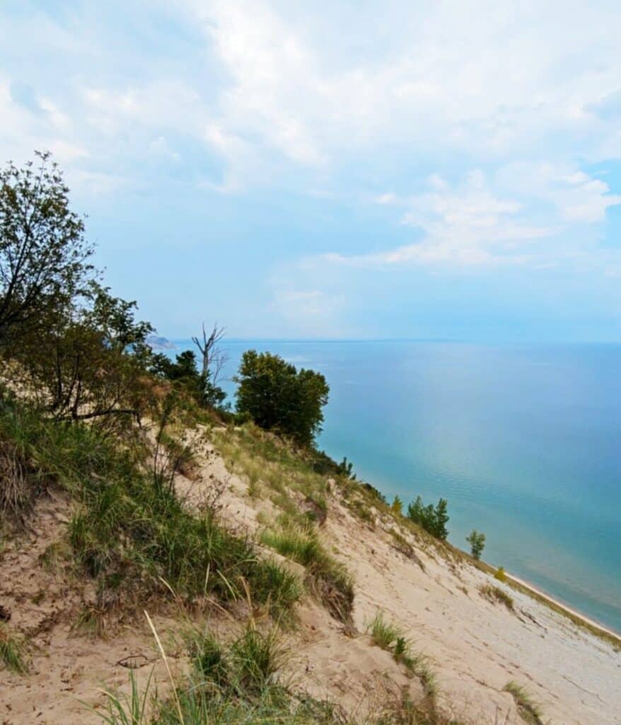
The Pierce Stocking Scenic Drive is a 7.4-mile paved loop inside Sleeping Bear with twelve numbered stops. The Dune Overlook and the Lake Michigan Overlook are the two that matter most for color framing water, and the forest stretches between stops are as good as the overlooks themselves in October.
This is also the best option on the whole list for anyone who cannot manage a trail — the loop is paved throughout and the views come from pull-offs. Arrive before 10 a.m. on fall weekends; the lots fill.
11. M-22 Segment Three: The Leelanau Peninsula
Follow M-22 north of Glen Arbor as it wraps the peninsula. Leland — Fishtown — has the historic fishing shanties, and in fall the salmon run the Leland River and jump the dam right in the middle of town. Stop at the Verterra tasting room before you leave.
Further north is Northport and the Grand Traverse Lighthouse, then back south into Suttons Bay along West Bay. Save your appetite for Martha’s Leelanau Table — the best French country cooking on this side of the state.
One timing note specific to the Leelanau: the inland forests peak in early October while the lakeshore towns run five to ten days behind. Drive inland first, then move toward the water. Full detail in the Leelanau Peninsula fall guide.

Fall Color Drives on the Sunrise Coast (US-23)
The US-23 Heritage Route, officially the Sunrise Coast Pure Michigan Byway, runs 200 miles from Standish north along the Lake Huron shoreline to Mackinaw City. It gets a fraction of the traffic the west side does and peaks on the same schedule. If a Saturday on M-22 sounds exhausting, come here instead.
12. Tawas and East Tawas
Tawas City and East Tawas are the easiest towns on this route to spend an afternoon in. Stop at the Village Chocolatier in East Tawas, then head out to Tawas Point State Park for the lighthouse.
The point itself is a long, curving spit of sand reaching into Lake Huron — you will swear you are on Cape Cod. A Recreation Passport gets you into the state park.
13. Oscoda, Greenbush, and Harrisville
Oscoda has one of the prettiest beachfront parks in Michigan. Pull into Oscoda Beach Park and walk the pier for shots of the coastline against the color. The Red Fork in Greenbush does hand-tossed pizza, and Harrisville State Harbor at the north end is worth the extra fifteen minutes.

14. Alpena, Ossineke, and Rogers City
Just before Ossineke, US-23 opens onto panoramic views of rolling hills and forest — have the camera out. Alpena is a genuinely good stop with a lot to do outdoors in fall.
Continue north toward Rogers City for the aqua water of Grand Lake near Presque Isle, one of the largest inland lakes in the state. While you are there, Ocqueoc Falls is eleven miles west of Rogers City off M-68 — the only universally accessible waterfall in the country, and in October the salmon are running up it.
15. Cheboygan to Mackinaw City
Cheboygan works in any season and is particularly good in fall — Lake Huron plus Mullett Lake and Black Lake means a lot of color reflected off blue water in a small area. Spend an hour downtown.
Mackinaw City is the natural place to end a Sunrise Coast run, with plenty of lodging. See the Mackinaw City hotels guide for where to stay before you head home or cross the bridge into the UP.

Bonus: River Road National Scenic Byway
The River Road National Scenic Byway runs about 22 miles west from Oscoda into the Huron National Forest along the Au Sable River to M-65 near Hale. It connects directly to the US-23 route in Oscoda, so it folds into a Sunrise Coast trip without a detour.
The overlooks sit on high sand bluffs above the river valley, which is what makes this drive work — you are looking down across the color rather than through it. Stop at Iargo Springs, the Canoer’s Memorial above Cooke Dam Pond, and the Lumberman’s Monument, which tells the story of the logging industry that stripped and then rebuilt this part of the state.
💡 PRO TIP: Most sites along River Road have barrier-free access, which makes this the most wheelchair-friendly color drive on this entire list. Tune your radio to 1610 AM along the byway for interpretive information about what you are looking at.
Michigan Fall Color Drives: Questions & Answers
What is the best fall color drive in Michigan?
M-22 is the most celebrated — 116 miles around the Leelanau Peninsula, voted the nation’s best autumn drive by USA Today 10Best readers. The M-119 Tunnel of Trees is the most dramatic 20 miles, though two sections are closed to through traffic in 2026. For an elevated view, Brockway Mountain Drive above Copper Harbor is the best in the state.
Is the Tunnel of Trees open for fall 2026?
Partially. April 2026 flooding washed out two sections of M-119, closing the road to through traffic between Terpening Road and Robinson Road near Good Hart, and again between Island View Road and Cross Village. Marked detours keep the businesses along the route reachable. Check current conditions before you drive.
When should I take a Michigan fall color drive?
Upper Peninsula drives peak from the last days of September into the first two weeks of October. Northern Lower Michigan — the Tunnel of Trees, M-22, Old Mission — peaks the second and third weeks of October. The Lake Huron Sunrise Coast runs on the same schedule as the Lower Peninsula. Lake Michigan shoreline towns run five to ten days behind nearby inland forests.
Which Michigan fall color drive is best for wheelchairs?
The River Road National Scenic Byway near Oscoda — most of its overlooks have barrier-free access. The Pierce Stocking Scenic Drive at Sleeping Bear is fully paved with views from the pull-offs, and the Lake of the Clouds overlook in the Porcupine Mountains has an accessible boardwalk.
Do I need a pass for Michigan fall color drives?
For most, no — the byways themselves are free. Sleeping Bear Dunes National Lakeshore, which includes the Pierce Stocking Scenic Drive, charges $25 per vehicle for seven days or $45 for an annual pass. Michigan state parks including Tawas Point require a Recreation Passport, which is $15 a year on Michigan plates or $12 a day for out-of-state vehicles.
What is the least crowded fall color drive in Michigan?
The US-23 Sunrise Coast route along Lake Huron, and the Black River National Forest Scenic Byway in the western Upper Peninsula. Both peak on normal schedules with a fraction of the traffic that the M-22 and M-119 corridors see on October weekends.
Before You Go
Pick one region and give it a full day. Go mid-week if you possibly can — the color is identical on a Tuesday and the roads are not. And check conditions before you commit, because a single windstorm can end peak in a day.
More fall planning: Michigan peak fall colors by region, the fall color map, cider mills and apple orchards, and Michigan fall festivals.
About the Author
Jill Halpin has covered Michigan travel for more than a decade, from summer swims on quiet beaches to winter ski trails and fall color road trips. She is a recurring travel contributor on WDIV Detroit, FOX 17 West Michigan, FOX 2 Detroit, FOX 32 Chicago, and WGN Chicago, and a member of the Travel Industry Coalition of Michigan and the Discover Iosco County Travel Board.
- About Jill
- Recent Michigan Travel Tips

Jill Halpin is a Michigan travel expert and founder of MyMichiganBeach.com. She has been sourced by The Washington Post and featured in The Detroit News and Detroit Free Press, and appears regularly on WDIV Detroit, FOX 2 Detroit, FOX 17 West Michigan, FOX 32 Chicago, WGN Chicago, and NewsNation — 60+ television appearances to date. She holds an MLIS from Wayne State University and is a Library of Congress Information Science Fellow. See all media features.